

| The Cooper County Missouri Historical Cemetery Society during the years 1967 to 1981 under took a project of compiling a record of all the cemeteries in Cooper County. A truely monumental process; and one that they achieved with the exception of Walnut Grove Cemetery in Boonville, Missouri. The Cooper County Historical Society is currently undertaking a project of updating the compiled cemetery records with new additions and changes. The Cooper County Historical Society has also given permission for those records to be placed on this web site; and what follows is a the beginning of a list of 196 cemeteries. The placing of those records on this site was a long process. We have had a number of volunteers to help on this project and we would like to thank our volunteers for their work. Cemetery locations can be found using our Sectional and Township Maps. or  Cemetery Locations Listing. To back calculate a birth or death date from either date and the length of one's life, please use our birthdate calculator. Cemetery Locations Listing. To back calculate a birth or death date from either date and the length of one's life, please use our birthdate calculator.Walnut Grove Cemetery located in Boonville, Missouri and containing over 8,000 graves has never been canvassed. It is highly improbable that it will be done anytime in the near future. To overcome this shortfall in our cemetery lists we are asking that anyone who has a relative buried in Walnut Grove to e-Mail us with the information for inclusion in our lists. To date we have approximately 4,574 names added to this cemetery list. |
| Map | |
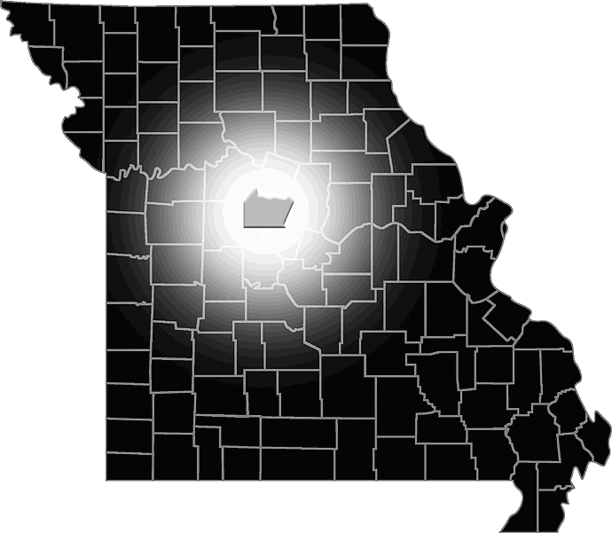
Adams Family Burial Plot | |||
| Quadrant Map : | Boonville | ||||
| General Location : | East of Boonville | ||||
| Congressional Township : | Township 49-N; Range 16-W | ||||
| Section : | NE Quarter of SE Quarter of SE Quarter of Section 33 | ||||
| Longitude & Latitude : | To Be Determined | ||||
| Map | |
Adams - Sowers Cemetery | |||
| Quadrant Map : | Clifton City* | ||||
| General Location : | North of Clifton City | ||||
| Congressional Township : | Township 47-N; Range 19-W | ||||
| Section : | NE Quarter of SW Quarter of SE Quarter of NW Quarter of Section 20 | ||||
| Longitude & Latitude : | 38° 49' 59" N, 93° 01' 54" W | ||||
| Alternate Name : | Sowers Cemetery | ||||
| Alternate Name : | Woolery Cemetery | ||||
| Map |
|
Allison Family Cemetery | |||
| Quadrant Map : | Pilot Grove North | ||||
| General Location : | South of Blackwater | ||||
| Congressional Township : | Township 48-N; Range 19-W | ||||
| Section : | NE Quarter of NW Quarter of Section 14 | ||||
| Longitude & Latitude : | 38° 93' 30" N, 92° 97' 50" W | ||||
| Map | |
Antioch Cemetery | |||
| Quadrant Map : | Otterville East* | ||||
| General Location : | South Southeast of New Lebanon | ||||
| Congressional Township : | Township 46-N; Range 18-W | ||||
| Section : | SE Quarter of SE Quarter of SE Quarter of NW Quarter of Section 20 | ||||
| Longitude & Latitude : | 38° 44' 13" N, 92° 55' 24" W | ||||
| Map | |
Apperson Cemetery | |||
| Quadrant Map : | Lone Elm | ||||
| General Location : | Southwest of Prairie Home | ||||
| Congressional Township : | Township 47-N; Range 16-W | ||||
| Section : | SE Quarter of SW Quarter of SW Quarter of Section 36 | ||||
| Longitude & Latitude : | To Be Determined | ||||
| Map | |
Ashley Burial Ground | |||
| Quadrant Map : | Billingsville | ||||
| General Location : | North of Lamine | ||||
| Congressional Township : | Township 49-N; Range 18-W | ||||
| Section : | Section 26 or 35 | ||||
| Longitude & Latitude : | To Be Determined | ||||
| Map | |
Bales Family Cemetery | |||
| Quadrant Map : | Lone Elm | ||||
| General Location : | Northwest of Prairie Home | ||||
| Congressional Township : | Township 47-N; Range 16-W | ||||
| Section : | NW Quarter of NE Quarter of Section 10 | ||||
| Longitude & Latitude : | To Be Determined | ||||
| Map | |
Baughman Family Cemetery | |||
| Quadrant Map : | Lone Elm | ||||
| General Location : | South of Pisgah | ||||
| Congressional Township : | Township 46-N; Range 16-W | ||||
| Section : | SW Quarter of Section 23 | ||||
| Longitude & Latitude : | To Be Determined | ||||
| Map | |
Baxter Cemetery | |||
| Quadrant Map : | Tipton | ||||
| General Location : | South Southeast of Bunceton | ||||
| Congressional Township : | Township 46-N; Range 17-W | ||||
| Section : | SE Quarter of SW Quarter of Section 27 | ||||
| Longitude & Latitude : | To Be Determined | ||||
| Map | |
Berea Christian Church Cemetery | |||
| Quadrant Map : | Nelson* | ||||
| General Location : | Southwest of Blackwater | ||||
| Congressional Township : | Township 48-N; Range 19-W | ||||
| Section : | NE Quarter of NE Quarter of NW Quarter of SE Quarter of Section 30 | ||||
| Longitude & Latitude : | 38° 90' 19" N, 93° 04' 02" W | ||||
| Alternate Name : | Lost Corners Cemetery | ||||
| Map | |
Bethel AME Church Cemetery | |||
| Quadrant Map : | Bunceton | ||||
| General Location : | Northwest of Speed | ||||
| Congressional Township : | Township 47-N; Range 17-W | ||||
| Section : | NE Quarter of NE Quarter of NW Quarter of SW Quarter of Section 8 | ||||
| Longitude & Latitude : | 38° 51' 14" N, 92° 48' 40" W | ||||
| Map | |
Bethlehem Cemetery | |||
| Quadrant Map : | Bunceton* | ||||
| General Location : | Southwest of Bunceton | ||||
| Congressional Township : | Township 46-N; Range 18-W | ||||
| Section : | SW Quarter of SW Quarter of SE Quarter of NE Quarter of Section 14 | ||||
| Longitude & Latitude : | 38° 45' 04" N, 92° 51' 40" | ||||
| Map | |
Beulah Baptist Church Cemetery | |||
| Quadrant Map : | Otterville East | ||||
| General Location : | East of Otterville | ||||
| Congressional Township : | Township 45-N; Range 18-W | ||||
| Section : | E Half of NW Quarter of Section 4 | ||||
| Longitude & Latitude : | To Be Determined | ||||
| Map | |
Bidstrup Family Cemetery | |||
| Quadrant Map : | Clifton City | ||||
| General Location : | North of Clifton City | ||||
| Congressional Township : | Township 47-N; Range 19-W | ||||
| Section : | Southeast Quarter of NE Quarter of Section 31 | ||||
| Longitude & Latitude : | 38° 80' 90" N, 93° 04' 30" | ||||
| Map | |
Boonville Memorial Gardens | |||
| Quadrant Map : | Boonville | ||||
| General Location : | Maple Street in Boonville | ||||
| Congressional Township : | Township 49-N; Range 17-W | ||||
| Section : | Section 36 | ||||
| Longitude & Latitude : | 38° 96' 65" N, 92° 72' 72" W | ||||
| Map | |
Bowles Cemetery | |||
| Quadrant Map : | Lone Elm | ||||
| General Location : | Southwest of Prairie Home | ||||
| Congressional Township : | Township 46-N; Range 16-W | ||||
| Section : | NE Quarter of SW Quarter of Section 2 | ||||
| Longitude & Latitude : | To Be Determined | ||||
| Map | |
Boys Training School Cemetery | |||
| Quadrant Map : | Boonville | ||||
| General Location : | Across Lilly Street from Sts. Peter and Paul Catholic Cemetery | ||||
| Congressional Township : | Township 49-N; Range 17-W | ||||
| Section : | NW Quarter of SE Quarter of Section 36 | ||||
| Longitude & Latitude : | 38° 97' 26" N, 92° 74' 05" W | ||||
| Map | |
Briscoe Cemetery | |||
| Quadrant Map : | Bunceton* | ||||
| General Location : | West of Bunceton | ||||
| Congressional Township : | Township 47-N; Range 18-W | ||||
| Section : | NW Quarter of NW Quarter of NW Quarter of NW Quarter of Section 35 | ||||
| Longitude & Latitude : | 38° 48' 08" N, 92° 51' 15" W | ||||
| Map | |
Brown Family Cemetery | |||
| Quadrant Map : | Billingsville | ||||
| General Location : | Southeast of Billingsville | ||||
| Congressional Township : | Township 48-N; Range 17-W | ||||
| Section : | NE Quarter of SE Quarter of Section 34 | ||||
| Longitude & Latitude : | 38° 88' 10" N, 92° 76' 10" W | ||||
| Alternate Name : | Cartner Family Cemetery | ||||
| Map | |
Brown Town Cemetery | |||
| Quadrant Map : | Rocheport | ||||
| General Location : | West of Overton | ||||
| Congressional Township : | Township 48-N; Range 15-W | ||||
| Section : | SW Quarter of SW Quarter of the NW Quarter of the NW Quarter of Section 5 | ||||
| Longitude & Latitude : | To Be Determined | ||||
| Map | |
Bunceton Masonic Cemetery | |||
| Quadrant Map : | Bunceton* | ||||
| General Location : | North of Bunceton | ||||
| Congressional Township : | Township 46-N; Range 17-W | ||||
| Section : | NE Quarter of NE Quarter of NE Quarter of SE Quarter of Section 32 | ||||
| Longitude & Latitude : | 38° 47' 41" N, 92° 48' 02" W | ||||
| Map | |
Byler Burial Plot | |||
| Quadrant Map : | Prairie Home | ||||
| General Location : | South of Boonville | ||||
| Congressional Township : | Township 48-N; Range 16-W | ||||
| Section : | SE Quarter of SE Quarter of Section 31 | ||||
| Longitude & Latitude : | 38° 87' 80" N, 92° 70' 80" W | ||||
| Map | |
Byler Family Cemetery | |||
| Quadrant Map : | Boonville | ||||
| General Location : | South of Boonville | ||||
| Congressional Township : | Township 48-N; Range 16-W | ||||
| Section : | NE Quarter of SW Quarter of Section 18 | ||||
| Longitude & Latitude : | 38° 92' 30" N, 92° 71' 60" W | ||||
| Map | |
Camp Ground at Pleasant Grove Cemetery | |||
| Quadrant Map : | Prairie Home | ||||
| General Location : | Northeast of Prairie Home | ||||
| Congressional Township : | Township 47-N; Range 15-W | ||||
| Section : | SE Quarter of NE Quarter of Section 3 | ||||
| Longitude & Latitude : | 38° 51' 27" N, 92° 32' 52" W | ||||
| Map | |
Campbell and Kelly Family Cemetery | |||
| Quadrant Map : | Bunceton | ||||
| General Location : | Southeast of Bunceton | ||||
| Congressional Township : | Township 46-N; Range 17-W | ||||
| Section : | SE Quarter of NE Quarter of Section 10 | ||||
| Longitude & Latitude : | To Be Determined | ||||
| Map | |
Campbell Family Cemetery | |||
| Quadrant Map : | Rocheport* | ||||
| General Location : | Southwest of Wooldridge | ||||
| Congressional Township : | Township 48-N; Range 15-W | ||||
| Section : | SE Quarter of SE Quarter of Section 22 | ||||
| Longitude & Latitude : | 38° 89' 80" N, 92° 53' 80" W | ||||
| Map | |
Carpenter and Reavis Cemetery | |||
| Quadrant Map : | Lone Elm | ||||
| General Location : | East of Bunceton | ||||
| Congressional Township : | Township 47-N; Range 16-W | ||||
| Section : | NE Quarter of NW Quarter of SE Quarter of SE Quarter of Section 33 | ||||
| Longitude & Latitude : | To Be Determined | ||||
| Map | |
Carr Family Cemetery | |||
| Quadrant Map : | Bunceton | ||||
| General Location : | Southwest of Bunceton | ||||
| Congressional Township : | Township 46-N; Range 18-W | ||||
| Section : | SE Quarter of NE Quarter of Section 14 | ||||
| Longitude & Latitude : | To Be Determined | ||||
| Map | |
Carroll Lone Grave | |||
| Quadrant Map : | Pilot Grove South | ||||
| General Location : | Southeast of Pilot Grove | ||||
| Congressional Township : | Township 47-N; Range 18-W | ||||
| Section : | NW Quarter of NW Quarter of Section 10 | ||||
| Longitude & Latitude : | To Be Determined | ||||
| Map | |
Cash (Kirsch)Family Plot | |||
| Quadrant Map : | Pilot Grove North / South | ||||
| General Location : | West of Pilot Grove | ||||
| Congressional Township : | Township 47-N; Range 19-W | ||||
| Section : | SE Quarter of NW Quarter of Section 12 | ||||
| Longitude & Latitude : | To Be Determined | ||||
| Map | |
Castleman Farm Cemetery | |||
| Quadrant Map : | Bunceton | ||||
| General Location : | South of Bunceton | ||||
| Congressional Township : | Township 46-N; Range 17-W | ||||
| Section : | NW Quarter of NW Quarter of Section 4 | ||||
| Longitude & Latitude : | To Be Determined | ||||
| Alternate Name : | Wallace Family Cemetery | ||||
| Map | |
Chilton Cemetery | |||
| Quadrant Map : | Tipton | ||||
| General Location : | South Southeast of Bunceton | ||||
| Congressional Township : | Township 46-N; Range 17-W | ||||
| Section : | NE Quarter of SE Quarter of NW Quarter of SE Quarter of Section 15 | ||||
| Longitude & Latitude : | 38° 74' 72" N, 92° 76' 94" W | ||||
| Map | |
Clarks Fork Trinity Lutheran Church Cemetery | |||
| Quadrant Map : | Lone Elm* | ||||
| General Location : | West Northwest of Prairie Home | ||||
| Congressional Township : | Township 47-N; Range 16-W | ||||
| Section : | SE Quarter of NE Quarter of NW Quarter of SW Quarter of Section 9 | ||||
| Longitude & Latitude : | 38° 51' 03" N, 92° 40' 57" W | ||||
| Map | |
Clarkson Family Burial Ground | |||
| Quadrant Map : | Prairie Home | ||||
| General Location : | Near Splice Creek Cemetery | ||||
| Congressional Township : | Township 47-N; Range 15-W | ||||
| Section : | NW Quarter of NW Quarter of Section 15 | ||||
| Longitude & Latitude : | To Be Determined | ||||
| Map | |
Clay Cemetery | |||
| Quadrant Map : | Clarksburg | ||||
| General Location : | Southeast of Bunceton | ||||
| Congressional Township : | Township 46-N; Range 17-W | ||||
| Section : | NW Quarter of SE Quarter of Section 25 | ||||
| Longitude & Latitude : | To Be Determined | ||||
| Map | |
Clayton Cemetery | |||
| Quadrant Map : | Rocheport* | ||||
| General Location : | Southeast of Overton | ||||
| Congressional Township : | Township 48-N; Range 15-W | ||||
| Section : | SW Quarter of SE Quarter of SE Quarter of SE Quarter of Section 5 | ||||
| Longitude & Latitude : | 38° 56' 35" N, 92° 34' 28" W | ||||
| Map | |
Coleman Family Burial Ground | |||
| Quadrant Map : | Pilot Grove North | ||||
| General Location : | Eastern edge of the City of Pilot Grove | ||||
| Congressional Township : | Township 48-N; Range 18-W | ||||
| Section : | SW Quarter of SW Quarter of Section 33 | ||||
| Longitude & Latitude : | To Be Determined | ||||
| Map | |
Concord Cemetery | |||
| Quadrant Map : | Lone Elm* | ||||
| General Location : | West of Lone Elm | ||||
| Congressional Township : | Township 47-N; Range 17-W | ||||
| Section : | SE Quarter of SE Quarter of SE Quarter of SE Quarter of Section 21 | ||||
| Longitude & Latitude : | 38° 82' 00" N, 92° 77' 97" W | ||||
| Map | |
Connor's Mill Cemetery | |||
| Quadrant Map : | Rocheport | ||||
| General Location : | West northwest of Woolridge | ||||
| Congressional Township : | Township 48-N; Range 15-W | ||||
| Section : | NE Quarter of NW Quarter of Section 18 | ||||
| Longitude & Latitude : | 38.92788 N, 92.60927 W | ||||
| Map | |
Copps Chapel Cemetery | |||
| Quadrant Map : | To Be Determined | ||||
| General Location : | Wooldridge | ||||
| Congressional Township : | Township 48-N; Range 15-W | ||||
| Section : | SE Quarter of Section 25 in Moniteau County, Missouri | ||||
| Longitude & Latitude : | To Be Determined | ||||
| Map | |
County Poor Farm Cemetery | |||
| Quadrant Map : | Bunceton | ||||
| General Location : | South Southwest of Billingsville near Bell Air | ||||
| Congressional Township : | Township 47-N; Range 17-W | ||||
| Section : | SE Quarter of SE Quarter of Section 6 | ||||
| Longitude & Latitude : | To Be Determined | ||||
| Map | |
Cropper Family Burial Plot | |||
| Quadrant Map : | Rocheport | ||||
| General Location : | South of Overton | ||||
| Congressional Township : | Township 48-N; Range 15-W | ||||
| Section : | SW Quarter of SW Quarter of Southwest Quarter of NW Quarter of Section 5 | ||||
| Longitude & Latitude : | To Be Determined | ||||
| Map | |
Davis Cemetery | |||
| Quadrant Map : | Lone Elm | ||||
| General Location : | Southeast of Bunceton | ||||
| Congressional Township : | Township 46-N; Range 17-W | ||||
| Section : | NE Quarter of NE Quarter of Section 14 | ||||
| Longitude & Latitude : | To Be Determined | ||||
| Map | |
Douglas Cemetery | |||
| Quadrant Map : | Lone Elm | ||||
| General Location : | East of Lone Elm | ||||
| Congressional Township : | Township 47-N; Range 16-W | ||||
| Section : | SE Quarter of SE Quarter of Section 20 | ||||
| Longitude & Latitude : | To Be Determined | ||||
| Map | |
Ellis Cemetery Number One | |||
| General Location : | West of Prairie Home | ||||
| Congressional Township : | Township 47-N; Range 16-W | ||||
| Section : | SW Quarter of NW Quarter of NW Quarter of NE Quarter of Section 26 | ||||
| Longitude & Latitude : | 38° 18' 12" N, 92° 64' 11" W | ||||
| Alternate Name : | Johnson Family Cemetery | ||||
| Alternate Name : | Woodlawn Farm Cemetery | ||||
| Map | |
Ellis Cemetery Number Two | |||
| Quadrant Map : | To Be Determined | ||||
| General Location : | Clear Creek | ||||
| Congressional Township : | Township 47-N; Range 19-W | ||||
| Section : | To Be Determined | ||||
| Longitude & Latitude : | To Be Determined | ||||
| Map | |
Ellis Family Burial Ground | |||
| Quadrant Map : | Pilot Grove | ||||
| General Location : | West of Pilot Grove | ||||
| Congressional Township : | Township 47-N; Range 19-W | ||||
| Section : | To Be Determined | ||||
| Longitude & Latitude : | To Be Determined | ||||
| Map | |
Engels Family Burial Plot | |||
| Quadrant Map : | Billingsville | ||||
| General Location : | West of Boonville | ||||
| Congressional Township : | Township 49-N; Range 18-W | ||||
| Section : | NW Quarter of SE Quarter of Section 36 | ||||
| Longitude & Latitude : | 38° 97' 10" N, 92° 83' 50" W | ||||
| Map | |
Erhardt Family Plot | |||
| Quadrant Map : | Rocheport | ||||
| General Location : | East of Boonville | ||||
| Congressional Township : | Township 48-N; Range 16-W | ||||
| Section : | SW Quarter of the NE Quarter of Section 2 | ||||
| Longitude & Latitude : | To Be Determined | ||||
| Map | |
Ewing Family Cemetery | |||
| Quadrant Map : | Bunceton | ||||
| General Location : | Northwest of Bunceton | ||||
| Congressional Township : | Township 47-N; Range 18-W | ||||
| Section : | SW Quarter of NE Quarter of Section 24 | ||||
| Longitude & Latitude : | To Be Determined | ||||
| Map | |
Fair Grounds Burial Plot | |||
| Quadrant Map : | Boonville | ||||
| General Location : | East Morgan Street in Boonville | ||||
| Congressional Township : | Township 47-N; Range 18-W | ||||
| Section : | Section 36 | ||||
| Longitude & Latitude : | 38° 97' 91" N, 92° 73' 00" W | ||||
| Map | |
Farris Family Cemetery | |||
| Quadrant Map : | Boonville | ||||
| General Location : | East Southeast of Boonville | ||||
| Congressional Township : | Township 48-N; Range 16-W | ||||
| Section : | SW Quarter of SE Quarter of Section 11 | ||||
| Longitude & Latitude : | 38° 93' 00" N, 92° 63' 90" W | ||||
| Map | |
Finis Creek Negro Cemetery | |||
| Quadrant Map : | To Be Determined | ||||
| General Location : | Marshall | ||||
| Congressional Township : | Township 48-N; Range 21-W | ||||
| Section : | Section 15 | ||||
| Longitude & Latitude : | To Be Determined | ||||
| Map | |
Finley Family Cemetery | |||
| Quadrant Map : | Otterville East | ||||
| General Location : | Otterville | ||||
| Congressional Township : | Township 45-N; Range 19-W | ||||
| Section : | Section 3 | ||||
| Longitude & Latitude : | To Be Determined | ||||
| Map | |
Fritz Family Cemetery | |||
| Quadrant Map : | Arrow Rock | ||||
| General Location : | Nelson | ||||
| Congressional Township : | Township 49-N; Range 18-W | ||||
| Section : | Section 7 | ||||
| Longitude & Latitude : | 39° 03' 20" N, 92° 92' 50" W | ||||
| Map | |
Gooch Mill Baptist Church Cemetery | |||
| Quadrant Map : | Rocheport* | ||||
| General Location : | Gooch Mill | ||||
| Congressional Township : | Township 48-N; Range 15-W | ||||
| Section : | NE Quarter of SW Quarter of SE Quarter of SE Quarter of Section 20 | ||||
| Longitude & Latitude : | 38° 54' 00" N, 92° 34' 40" W | ||||
| Alternate Name : | Big Lick Cemetery | ||||
| Map | |
Goodwin Family Cemetery | |||
| Quadrant Map : | Tipton | ||||
| General Location : | Southest of Bunceton | ||||
| Congressional Township : | Township 46-N; Range 17-W | ||||
| Section : | NW Quarter of NW Quarter of SW Quarter of Section 15 | ||||
| Longitude & Latitude : | To be determined | ||||
| Map | |
Green Family Cemetery | |||
| Quadrant Map : | Arrow Rock | ||||
| General Location : | NE of Blackwater | ||||
| Congressional Township : | Township 48-N; Range 18-W | ||||
| Section : | NW Quarter of NW Quarter of Section 17 | ||||
| Longitude & Latitude : | 39° 01' 80" N, 92° 91' 80" W | ||||
| Map | |
Greenhalgh Cemetery | |||
| Quadrant Map : | Lone Elm | ||||
| General Location : | North of Lone Elm | ||||
| Congressional Township : | Township 47-N; Range 17-W | ||||
| Section : | NW Quarter of NW Quarter of NW Quarter of Section 1 | ||||
| Longitude & Latitude : | To Be Determined | ||||
| Map | |
Grotto Burial Plot | |||
| Quadrant Map : | Boonville | ||||
| General Location : | East Morgan Street in Boonville | ||||
| Congressional Township : | Township 49-N; Range 17-W | ||||
| Section : | Section 36 | ||||
| Longitude & Latitude : | 38° 97' 95" N, 92° 73' 04" W | ||||
| Map | |
Guyer Family Cemetery | |||
| Quadrant Map : | Lone Elm | ||||
| General Location : | Southwest of Pisgah | ||||
| Congressional Township : | Township 46-N; Range 16-W | ||||
| Section : | NW Quarter of SE Quarter of Section 10 | ||||
| Longitude & Latitude : | To Be Determined | ||||
| Map | |
Haas Family Plot | |||
| Quadrant Map : | Boonville | ||||
| General Location : | Western Boonville | ||||
| Congressional Township : | Township 49-N; Range 17-W | ||||
| Section : | NW Quarter of Section 34 | ||||
| Longitude & Latitude : | To Be Determined | ||||
| Map | |
Hail Ridge Cemetery | |||
| Quadrant Map : | Boonville* | ||||
| General Location : | Southeast of Boonville | ||||
| Congressional Township : | Township 48-N; Range 16-W | ||||
| Section : | SW Quarter of NW Quarter of NW Quarter of SE Quarter of Section 8 | ||||
| Longitude & Latitude : | 38° 56' 22" N, 92° 41' 39" W | ||||
| Map | |
Hale and Gabriel Family Cemetery | |||
| Quadrant Map : | Rocheport | ||||
| General Location : | West of Gooch Mill | ||||
| Congressional Township : | Township 48-N; Range 16-W | ||||
| Section : | SE Quarter of SE Quarter of NE Quarter of NE Quarter of Section 36 | ||||
| Longitude & Latitude : | 38° 88' 19" N, 92° 61' 24" W | ||||
| Map | |
Harlan Family Cemetery | |||
| Quadrant Map : | Clifton City | ||||
| General Location : | South of Clifton City | ||||
| Congressional Township : | Township 46-N; Range 19-W | ||||
| Section : | NE Quarter of NE Quarter of Section 19 | ||||
| Longitude & Latitude : | To be determined | ||||
| Map | |
Harris Cemetery | |||
| Quadrant Map : | Prairie Home* | ||||
| General Location : | South of Prairie Home | ||||
| Congressional Township : | Township 47-N; Range 15-W | ||||
| Section : | NW Quarter of NW Quarter of SW Quarter of SE Quarter of Section 31 | ||||
| Longitude & Latitude : | 38° 47' 10" N, 92° 36' 18" W | ||||
| Alternate Name : | Odneal Cemetery | ||||
| Map | |
Hartzog Family Plot | |||
| Quadrant Map : | Clarksburg | ||||
| General Location : | North northeast of Clarksburg | ||||
| Congressional Township : | Township 46-N; Range 15-W | ||||
| Section : | W Half of SW Quarter of Section 30 | ||||
| Longitude & Latitude : | To be determined | ||||
| Map | |
Herndon Family Cemetery | |||
| Quadrant Map : | Pilot Grove N | ||||
| General Location : | North of Lamine | ||||
| Congressional Township : | Township 48-N; Range 18-W | ||||
| Section : | NE Quarter of NE Quarter of SE Quarter of NW Quarter of Section 3 | ||||
| Longitude & Latitude : | 38° 57' 32" N, 92° 52' 36" W | ||||
| Map | |
Higgerson Family Cemetery | |||
| Quadrant Map : | Pilot Grove N | ||||
| General Location : | North of Lamine | ||||
| Congressional Township : | Township 49-N; Range 18-W | ||||
| Section : | SW Quarter of NW Quarter of Section 34 | ||||
| Longitude & Latitude : | 38° 97' 10" N, 92° 88' 30" W | ||||
| Map | |
Hoberecht Cemetery | |||
| Quadrant Map : | Rocheport | ||||
| General Location : | West of Overton | ||||
| Congressional Township : | Township 48-N; Range 16-W | ||||
| Section : | NE Quarter of NE Quarter of Section 1 | ||||
| Longitude & Latitude : | 38.960076,-92.609425 | ||||
| Map | |
Hoke Family Cemetery | |||
| Quadrant Map : | Arrow Rock* | ||||
| General Location : | Northeast of Blackwater | ||||
| Congressional Township : | Township 49-N; Range 18-W | ||||
| Section : | NW Quarter of NW Quarter of NW Quarter of NE Quarter of Section 13 | ||||
| Longitude & Latitude : | 39° 01' 25" N, 92° 56' 53" W | ||||
| Map | |
Hopewell Church Cemetery | |||
| Quadrant Map : | Tipton* | ||||
| General Location : | South Southeast of Blackwater | ||||
| Congressional Township : | Township 46-N; Range 17-W | ||||
| Section : | NW Quarter of NW Quarter of SW Quarter of SW Quarter of Section 26 | ||||
| Longitude & Latitude : | 38° 43' 02" N, 92° 45' 45" W | ||||
| Map | |
Houk Cemetery | |||
| Quadrant Map : | Prairie Home | ||||
| General Location : | SE of Prairie Home just over the county line | ||||
| Congressional Township : | Township 47-N; Range 15-W | ||||
| Section : | NW Quarter of NE Quarter of Section 33 | ||||
| Longitude & Latitude : | To Be Determined | ||||
| Map | |
Howard Cemetery | |||
| Quadrant Map : | Tipton | ||||
| General Location : | South Southeast of Bunceton | ||||
| Congressional Township : | Township 45-N; Range 17-W | ||||
| Section : | SE Quarter of NW Quarter of Section 1 | ||||
| Longitude & Latitude : | 38° 69' 16" N, 92° 74' 13" W | ||||
| Alternate Name : | Grazier Cemetery | ||||
| Map | |
Hurd Family Cemetery | |||
| Quadrant Map : | Billingsville | ||||
| General Location : | West Southwest of Boonville | ||||
| Congressional Township : | Township 48-N; Range 18-W | ||||
| Section : | SW Quarter of SE Quarter of NE Quarter of Section 11 | ||||
| Longitude & Latitude : | To Be Determined | ||||
| Map | |
Hurt Family Cemetery | |||
| Quadrant Map : | Lone Elm | ||||
| General Location : | Clarks Fork | ||||
| Congressional Township : | Township 47-N; Range 16-W | ||||
| Section : | SE Quarter of SE Quarter of Section 5 | ||||
| Longitude & Latitude : | To Be Determined | ||||
| Map | |
Hutchison Family Cemetery | |||
| Quadrant Map : | Bunceton | ||||
| General Location : | West Northwest of Bunceton | ||||
| Congressional Township : | Township 47-N; Range 18-W | ||||
| Section : | NE Quarter of SW Quarter of Section 25 | ||||
| Longitude & Latitude : | To Be Determined | ||||
| Map | |
Jolly Bottom Cemetery | |||
| Quadrant Map : | Rocheport | ||||
| General Location : | Southwest of Overton | ||||
| Congressional Township : | Township 49-N; Range 15-W | ||||
| Section : | To Be Determined | ||||
| Longitude & Latitude : | To Be Determined | ||||
| Map | |
Jones Chapel Cemetery | |||
| Quadrant Map : | Billingsville | ||||
| General Location : | West Southwest of Boonville | ||||
| Congressional Township : | Township 48-N; Range 18-W | ||||
| Section : | SE Quarter of SW Quarter of SE Quarter of NE Quarter of Section 12 | ||||
| Longitude & Latitude : | 38° 56' 35" N, 92° 50' 05" W | ||||
| Map | |
Jones Hunt Family Cemetery | |||
| Quadrant Map : | Lone Elm* | ||||
| General Location : | East of Pisgah | ||||
| Congressional Township : | Township 46-N; Range 16-W | ||||
| Section : | NW Quarter of SE Quarter of NW Quarter of SE Quarter of Section 2 | ||||
| Longitude & Latitude : | 38° 77' 38" N, 92° 63' 94" W | ||||
| Map | |
Kaempfer Family Cemetery | |||
| Quadrant Map : | Prairie Home | ||||
| General Location : | East of Prairie Home | ||||
| Congressional Township : | Township 47-N; Range 15-W | ||||
| Section : | NW Quarter of SW Quarter of Section 22 | ||||
| Longitude & Latitude : | 38° 77' 38" N, 92° 63' 94" W | ||||
| Map | |
Kahle Family Burial Grounds | |||
| Quadrant Map : | Lone Elm | ||||
| General Location : | Northeast of Lone Elm | ||||
| Congressional Township : | Township 47-N; Range 16-W | ||||
| Section : | NW Quarter of SE Quarter of SE Quarter of Section 31 | ||||
| Longitude & Latitude : | To Be Determined | ||||
| Map | |
Klug Family Burial Plot | |||
| Quadrant Map : | Lone Elm | ||||
| General Location : | Northeast of Lone Elm | ||||
| Congressional Township : | Township 47-N; Range 16-W | ||||
| Section : | SE Quarter of NW Quarter of NE Quarter of Section 6 | ||||
| Longitude & Latitude : | To Be Determined | ||||
| Map | |
Lawless Family Cemetery | |||
| Quadrant Map : | To Be Determined | ||||
| General Location : | Arrow Rock | ||||
| Congressional Township : | Township 50-N; Range 19-W | ||||
| Section : | SE Quarter of SE Quarter of Section 36 | ||||
| Longitude & Latitude : | To Be Determined | ||||
| Map | | Lee Cemetery | |||
| Quadrant Map : | Pettis County, Missouri | ||||
| General Location : | West of Clifton City | ||||
| Congressional Township : | To Be Determined | ||||
| Section : | Section 14 | ||||
| Longitude & Latitude : | 38° 45' 21" N, 93° 05' 01" W | ||||
| Map | |
Leonard Family Burial Ground | |||
| Quadrant Map : | Bunceton | ||||
| General Location : | Northwest of Bunceton | ||||
| Congressional Township : | Township 47-N; Range 18-W | ||||
| Section : | NW Quarter of SW Quarter of Section 24 | ||||
| Longitude & Latitude : | To Be Determined | ||||
| Alternate Name : | Ravenswood Cemetery | ||||
| Map | |
Lilly Family Burial Grounds | |||
| Quadrant Map : | Boonville | ||||
| General Location : | East Boonville on Penitentiary Ground | ||||
| Congressional Township : | Township 49-N; Range 17-W | ||||
| Section : | NE Quarter of SE Quarter of SW Quarter of Section 25 | ||||
| Longitude & Latitude : | 38° 97' 00" N, 92° 73' 00" W | ||||
| Map | |
Lone Elm Christian Church Cemetery | |||
| Quadrant Map : | Bunceton | ||||
| General Location : | Northwest of Bunceton | ||||
| Congressional Township : | Township 47-N; Range 17-W | ||||
| Section : | NW Quarter of SW Quarter of Section 22 | ||||
| Longitude & Latitude : | 38° 49' 15" N, 92° 46' 42" W | ||||
| Map | |
Lonjers Private Burial Ground | |||
| Quadrant Map : | Lone Elm | ||||
| General Location : | Northwest of Prairie Home | ||||
| Congressional Township : | Township 47-N; Range 16-W | ||||
| Section : | SE Quarter of NW Quarter of Section 10 | ||||
| Longitude & Latitude : | To Be Determined | ||||
| Map | |
Lowery Family Burial Plot | |||
| Quadrant Map : | Pilot Grove South | ||||
| General Location : | Southeast of Pilot Grove | ||||
| Congressional Township : | Township 47-N; Range 18-W | ||||
| Section : | SE Quarter of SW Quarter of Section 10 | ||||
| Longitude & Latitude : | To Be Determined | ||||
| Map | |
Martin Cemetery | |||
| Quadrant Map : | Clarksburg | ||||
| General Location : | North Northwest of Clarksburg | ||||
| Congressional Township : | Township 46-N; Range 16-W | ||||
| Section : | E Half of NW Quarter of Section 33 | ||||
| Longitude & Latitude : | To Be Determined | ||||
| Map | |
McClanahan Family Cemetery | |||
| Quadrant Map : | Prairie Home | ||||
| General Location : | Northeast of Prairie Home | ||||
| Congressional Township : | Township 47-N; Range 15-W | ||||
| Section : | SW Quarter of NE Quarter of Section 10 | ||||
| Longitude & Latitude : | To Be Determined | ||||
| Map | |
McCulloch Cemetery | |||
| Quadrant Map : | Lone Elm* | ||||
| General Location : | West Northwest of Prairie Home | ||||
| Congressional Township : | Township 47-N; Range 16-W | ||||
| Section : | NW Quarter of NW Quarter of NE Quarter or NE Quarter of Section 21 | ||||
| Longitude & Latitude : | 38° 49' 47" N, 92° 40' 24" W | ||||
| Map | |
McCurdy Family Cemetery | |||
| Quadrant Map : | Tipton | ||||
| General Location : | South of Bunceton | ||||
| Congressional Township : | Township 46-N; Range 17-W | ||||
| Section : | SW Quarter of NW Quarter of Section 21 | ||||
| Longitude & Latitude : | To Be Determined | ||||
| Map | |
McFarland and Martin Plot | |||
| Quadrant Map : | Clarksburg | ||||
| General Location : | Southeast of Pisgah | ||||
| Congressional Township : | Township 48-N; Range 16-W | ||||
| Section : | SW Quarter of NE Quarter of Section 26 | ||||
| Longitude & Latitude : | To be determined | ||||
| Map | |
McFarland (Reuben) Cemetery | |||
| Quadrant Map : | Boonville | ||||
| General Location : | South of Boonville | ||||
| Congressional Township : | Township 48-N; Range 16-W | ||||
| Section : | SW Quarter of NW Quarter of Section 18 | ||||
| Longitude & Latitude : | 38° 92' 90" N, 92° 71' 70" W | ||||
| Map | |
McGuire Family Cemetery | |||
| Quadrant Map : | Pilot Grove North | ||||
| General Location : | West Southwest of Boonville | ||||
| Congressional Township : | Township 48-N; Range 18-W | ||||
| Section : | N Half of NE Quarter of Section 16 | ||||
| Longitude & Latitude : | 38° 93' 40" N, 92° 89' 00" W | ||||
| Map | |
McMahan (James) Family Cemetery | |||
| Quadrant Map : | Pilot Grove North | ||||
| General Location : | Northeast of Blackwater | ||||
| Congressional Township : | Township 49-N; Range 19-W | ||||
| Section : | NW Quarter of SE Quarter of Section 27 | ||||
| Longitude & Latitude : | 38° 98' 80" N, 92° 98' 00" W | ||||
| Alternate Name : | Fray Family Cemetery | ||||
| Map | |
McMahan (Samuel) Family Cemetery | |||
| Quadrant Map : | Arrow Rock | ||||
| General Location : | North Northwest of Lamine | ||||
| Congressional Township : | Township 49-N; Range 18-W | ||||
| Section : | NW Quarter of SW Quarter of NE Quarter of NE Quarter of Section 20 | ||||
| Longitude & Latitude : | 39° 00' 60" N, 92° 90' 72" W | ||||
| Map | |
McMahan (Thomas, Jr.) Cemetery | |||
| Quadrant Map : | Arrow Rock | ||||
| General Location : | North Northeast of Lamine | ||||
| Congressional Township : | Township 49-N; Range 19-W | ||||
| Section : | NW Quarter of NW Quarter of NE Quarter of Section 14 | ||||
| Longitude & Latitude : | 39° 02' 40" N, 92° 65' 50" W | ||||
| Map | |
McMahan (Thomas, Sr.) Family Cemetery | |||
| Quadrant Map : | Arrow Rock | ||||
| General Location : | North Northeast of Blackwater | ||||
| Congressional Township : | Township 49-N; Range 19-W | ||||
| Section : | NW Quarter of NW Quarter of Section 13 | ||||
| Longitude & Latitude : | 39° 02' 30" N, 92° 95' 20" W | ||||
| Map | |
McMillian Family Cemetery | |||
| Quadrant Map : | Billingsville | ||||
| General Location : | East Northeast of Billingsville | ||||
| Congressional Township : | Township 48-N; Range 17-W | ||||
| Section : | SE Quarter of SE Quarter of Section 22 | ||||
| Longitude & Latitude : | 38° 92' 70" N, 92° 76' 10" W | ||||
| Alternate Name : | McCarty Family Cemetery | ||||
| Map | |
McNuit Family Cemetery | |||
| Quadrant Map : | Arrow Rock | ||||
| General Location : | Northeast of Blackwater | ||||
| Congressional Township : | Township 49-N; Range 19-W | ||||
| Section : | SW Quarter of SW Quarter of Section 13 | ||||
| Longitude & Latitude : | 39° 01' 00" N, 92° 95' 60" W | ||||
| Alternate Name : | Gale Family Cemetery | ||||
| Map | |
Meredith Family Cemetery | |||
| Quadrant Map : | Prairie Home | ||||
| General Location : | East Northeast of Prairie Home | ||||
| Congressional Township : | Township 47-N; Range 15-W | ||||
| Section : | SW Quarter of NE Quarter of NE Quarter of Section 21 | ||||
| Longitude & Latitude : | To Be Determined | ||||
| Map | |
Mitchell Family Burial Ground | |||
| Quadrant Map : | Boonville | ||||
| General Location : | East Southeast of Boonville | ||||
| Congressional Township : | Township 48-N; Range 16-W | ||||
| Section : | SE Quarter of NE Quarter of Section 5 | ||||
| Longitude & Latitude : | 38° 95' 80" N, 92° 69' 00" W | ||||
| Map | |
Mitchell Family Cemetery | |||
| Quadrant Map : | Clifton City | ||||
| General Location : | North Northeast of Clifton City | ||||
| Congressional Township : | Township 47-N; Range 19-W | ||||
| Section : | SE Quarter of NW Quarter of Section 21 | ||||
| Longitude & Latitude : | 38° 83' 50" N, 93° 01' 00" W | ||||
| Alternate Name : | Dillard Cemetery | ||||
| Map | |
Moore Cemetery | |||
| Quadrant Map : | Lone Elm | ||||
| General Location : | Northeast of Speed | ||||
| Congressional Township : | Township 47-N; Range 17-W | ||||
| Section : | NW Quarter of NW Quarter of Section 3 | ||||
| Longitude & Latitude : | To Be Determined | ||||
| Map | |
Mt Herman Baptist Church Cemetery | |||
| Quadrant Map : | Boonville* | ||||
| General Location : | North of Lone Elm | ||||
| Congressional Township : | Township 48-N; Range 17-W | ||||
| Section : | SE Quarter of NW Quarter of NE Quarter of SW Quarter of Section 36 | ||||
| Longitude & Latitude : | 38° 52' 56" N, 92° 44' 02" W | ||||
| Map | |
Mt Moriah Cemetery | |||
| Quadrant Map : | Clifton City* | ||||
| General Location : | East Northeast of Clifton City | ||||
| Congressional Township : | Township 46-N; Range 19-W | ||||
| Section : | NW Quarter of NW Quarter of NW Quarter of NW Quarter of Section 10 | ||||
| Longitude & Latitude : | 38° 46' 33" N, 93° 00' 13" W | ||||
| Alternate Name : | A.M.E. Church Cemetery | ||||
| Map | |
Mt Nebo Baptist Church Cemetery | |||
| Quadrant Map : | Pilot Grove South* | ||||
| General Location : | West Northwest of Bunceton | ||||
| Congressional Township : | Township 47-N; Range 18-W | ||||
| Section : | SW Quarter of SE Quarter of SW Quarter of SW Quarter of Section 27 | ||||
| Longitude & Latitude : | 38° 48' 12" N, 92° 53' 22" W | ||||
| Map | |
Mt Nebo Cemetery (Old) |
|||
| Quadrant Map : | Pilot Grove South | ||||
| General Location : | West Northwest of Bunceton | ||||
| Congressional Township : | Township 47-N; Range 18-W | ||||
| Section : | NW Quarter of NE Quarter of Section 34 | ||||
| Longitude & Latitude : | To Be Determined | ||||
| Map | |
Mt Pleasant Cemetery | |||
| Quadrant Map : | Clarksburg* | ||||
| General Location : | Northeast of Clarksburg | ||||
| Congressional Township : | Township 46-N; Range 18-W | ||||
| Section : | SE Quarter of SE Quarter of SE Quarter of SE Quarter of Section 35 | ||||
| Longitude & Latitude : | 38° 41' 45" N, 92° 38' 09" W | ||||
| Map | |
Mt Vernon Cumberland Presbyterian Church Cemetery | |||
| Quadrant Map : | Pilot Grove South* | ||||
| General Location : | South of Pilot Grove | ||||
| Congressional Township : | Township 47-N; Range 18-W | ||||
| Section : | SW Quarter of SE Quarter of NW Quarter of NE Quarter of Section 8 | ||||
| Longitude & Latitude : | 38° 51' 31" N, 92° 54' 56" W | ||||
| Map | |
Murphy Family Cemetery | |||
| Quadrant Map : | Otterville East | ||||
| General Location : | Southeast of New Nebanon | ||||
| Congressional Township : | Township 46-N; Range 18-W | ||||
| Section : | Center of NE Quarter of Section 21 | ||||
| Longitude & Latitude : | To Be Determined | ||||
| Map | |
Nelson Family Cemetery | |||
| Quadrant Map : | Tipton | ||||
| General Location : | South of Bunceton | ||||
| Congressional Township : | Township 46-N; Range 17-W | ||||
| Section : | Center of NW Quarter of NW Quarter of Section 29 | ||||
| Longitude & Latitude : | To Be Determined | ||||
| Map | |
New Lebanon Cumberland Presbyterian Church Cemetery | |||
| Quadrant Map : | Pilot Grove South* | ||||
| General Location : | South of New Lebanon | ||||
| Congressional Township : | Township 46-N; Range 18-W | ||||
| Section : | W Half of SW Quarter of SW Quarter of SE Quarter of Section 7 | ||||
| Longitude & Latitude : | 38° 45' 33" N, 92° 56' 26" W | ||||
| Map | |
New Salem Cumberland Presbyterian Church Cemetery | |||
| Quadrant Map : | Lone Elm* | ||||
| General Location : | Northwest of Prairie Home | ||||
| Congressional Township : | Township 46-N; Range 16-W | ||||
| Section : | SW Quarter of SW Quarter of SE Quarter of SW Quarter of Section 12 | ||||
| Longitude & Latitude : | 38° 50' 35" N, 92° 37' 39" W | ||||
| Map | |
New Salem Missionary Baptist Church Cemetery | |||
| Quadrant Map : | Rocheport* | ||||
| General Location : | South of Gooch's Mill | ||||
| Congressional Township : | Township 48-N; Range 15-W | ||||
| Section : | NW Quarter of NW Quarter of SW Quarter of NW Quarter of Section 28 | ||||
| Longitude & Latitude : | 38° 53' 39" N, 92° 34' 27" W | ||||
| Alternate Name : | Buzzard Roost Cemetery | ||||
| Map | |
New Zion Cumberland Presbyterian Church Cemetery | |||
| Quadrant Map : | Clarksburg* | ||||
| General Location : | North Northeast of Clarksburg | ||||
| Congressional Township : | Township 46-N; Range 16-W | ||||
| Section : | NW Quarter of NW Quarter of NW Quarter of NE Quarter of Section 35 | ||||
| Longitude & Latitude : | 38° 42' 38" N, 92° 38' 35" W | ||||
| Map | |
Newbauer Family Burial Plot | |||
| Quadrant Map : | Billingsville | ||||
| General Location : | Southeast of Billingsville | ||||
| Congressional Township : | Township 48-N; Range 17-W | ||||
| Section : | Center of E Half of NE Quarter of SE Quarter of Section 28 | ||||
| Longitude & Latitude : | 38° 89' 70" N, 92° 78' 00" W | ||||
| Map | |
Oak Grove Cemetery Number One | |||
| Quadrant Map : | Billingsville | ||||
| General Location : | East of Billingsville | ||||
| Congressional Township : | Township 48-N; Range 17-W | ||||
| Section : | NE Quarter of NE Quarter of NE Quarter of NE Quarter of Section 28 | ||||
| Longitude & Latitude : | To Be Determined | ||||
| Map | |
Oak Grove Cemetery Number Two | |||
| Quadrant Map : | Rocheport | ||||
| General Location : | West Southwest of Gooch's Mill | ||||
| Congressional Township : | Township 48-N; Range 16-W | ||||
| Section : | NE Quarter of NW Quarter of NE Quarter of SE Quarter of Section 25 | ||||
| Longitude & Latitude : | 38° 89' 10" N, 92° 61' 40" W | ||||
| Map | |
Oakland Cemetery | |||
| Quadrant Map : | Clarksburg | ||||
| General Location : | North of Clarksburg | ||||
| Congressional Township : | Township 46-N; Range 16-W | ||||
| Section : | South Half of SE Quarter of SW Quarter of Section 28 | ||||
| Longitude & Latitude : | 38° 89' 10" N, 92° 61' 40" W | ||||
| Map | |
OBryan Family Cemetery | |||
| Quadrant Map : | Lone Elm | ||||
| General Location : | Southeast of Prairie Home | ||||
| Congressional Township : | Township 47-N; Range 16-W | ||||
| Section : | Section 35 | ||||
| Longitude & Latitude : | To Be Determined | ||||
| Alternate Name : | O'Brien Family Cemetery | ||||
| Map | |
Old Lamine Cemetery | |||
| Quadrant Map : | Pilot Grove North | ||||
| General Location : | East of Blackwater | ||||
| Congressional Township : | Township 49-N; Range 18-W | ||||
| Section : | SE Quarter of SE Quarter of NW Quarter of SE Quarter of Section 31 | ||||
| Longitude & Latitude : | 38° 58' 06" N, 92° 55' 39" W | ||||
| Map | |
Old Palestine Cemetery | |||
| Quadrant Map : | Bunceton | ||||
| General Location : | Southwest of Speed | ||||
| Congressional Township : | Township 47-N; Range 17-W | ||||
| Section : | NE Quarter of NE Quarter of NE Quarter of SE Quarter of Section 18 | ||||
| Longitude & Latitude : | To Be Determined | ||||
| Map | |
Old Presbyterian Church Cemetery | |||
| Quadrant Map : | Bunceton | ||||
| General Location : | South of Bunceton | ||||
| Congressional Township : | Township 47-N; Range 17-W | ||||
| Section : | SW Quarter of SW Quarter of Section 34 | ||||
| Longitude & Latitude : | To Be Determined | ||||
| Alternate Name : | Cross-Roads Church and Cemetery | ||||
| Map | |
Otterville Civil War Cemetery | |||
| Quadrant Map : | Otterville East & West | ||||
| General Location : | Northeast of Otterville | ||||
| Congressional Township : | Township 46-N; Range 19-W | ||||
| Section : | SW Quarter of Section 33 | ||||
| Longitude & Latitude : | To Be Determined | ||||
| Map | |
Otterville IOOF Cemetery | |||
| Quadrant Map : | Otterville East & West | ||||
| General Location : | North of Otterville | ||||
| Congressional Township : | Township 46-N; Range 19-W | ||||
| Section : | SE Quarter of NW Quarter of NW Quarter of SW Quarter of Section 34 | ||||
| Longitude & Latitude : | 38° 42' 35" N, 93° 00' 02" W | ||||
| Map | |
Parrish Family Cemetery | |||
| Quadrant Map : | Bunceton | ||||
| General Location : | West Northwest of Speed | ||||
| Congressional Township : | Township 47-N; Range 17-W | ||||
| Section : | SW Quarter of SE Quarter of Section 1 | ||||
| Longitude & Latitude : | To Be Determined | ||||
| Map | |
Parsons Family Cemetery | |||
| Quadrant Map : | Rocheport | ||||
| General Location : | East of Clark's Fork Crossroads | ||||
| Congressional Township : | Township 48-N; Range 16-W | ||||
| Section : | SE Quarter of NE Quarter of Section 36 | ||||
| Longitude & Latitude : | To Be Determined | ||||
| Map | |
Parsons Slave Cemetery | |||
| Quadrant Map : | Rocheport | ||||
| General Location : | East of Clark's Fork Crossroads | ||||
| Congressional Township : | Township 48-N; Range 16-W | ||||
| Section : | SE Quarter of NW Quarter of Section 36 | ||||
| Longitude & Latitude : | To Be Determined | ||||
| Map | |
Peninsula Baptist Church and Cemetery | |||
| Quadrant Map : | Pilot Grove North* | ||||
| General Location : | South of Blackwater | ||||
| Congressional Township : | Township 48-N; Range 19-W | ||||
| Section : | SE Quarter of SE Quarter of NE Quarter of NW Quarter of Section 10 | ||||
| Longitude & Latitude : | 38° 56' 54" N, 92° 59' 31" W | ||||
| Map | |
Phillips Burial Ground | |||
| Quadrant Map : | Pilot Grove | ||||
| General Location : | Southeast of Blackwater | ||||
| Congressional Township : | Township 48-N; Range 19-W | ||||
| Section : | SW Quarter of SE Quarter of Section 26 | ||||
| Longitude & Latitude : | 38° 89' 60" N, 93° 00' 70" W | ||||
| Alternate Name : | None | ||||
| Map | |
Pilot Grove City Cemetery | |||
| Quadrant Map : | Pilot Grove North* | ||||
| General Location : | North of Pilot Grove | ||||
| Congressional Township : | Township 48-N; Range 18-W | ||||
| Section : | E Half of NE Quarter of SW Quarter of SE Quarter of Section 32 | ||||
| Longitude & Latitude : | 38° 52' 40" N, 92° 54' 48" W | ||||
| Alternate Name : | Pilot Grove Methodist Episcopal Church South Cemetery | ||||
| Map | |
Pisgah Baptist Church Cemetery | |||
| Quadrant Map : | Lone Elm* | ||||
| General Location : | Southwest of Prairie Home | ||||
| Congressional Township : | Township 46-N; Range 16-W | ||||
| Section : | SW Quarter of SW Quarter of SW Quarter of NW Quarter of Section 2 | ||||
| Longitude & Latitude : | 38° 46' 39" N, 92° 39' 03" W | ||||
| Alternate Name : | Pisgah Community Cemetery | ||||
| Map | |
Pisgah Christian Cemetery | |||
| Quadrant Map : | Lone Elm* | ||||
| General Location : | Southwest of Prairie Home | ||||
| Congressional Township : | Township 46-N; Range 16-W | ||||
| Section : | SE Quarter of SE Quarter of SE Quarter of NW Quarter of Section 2 | ||||
| Longitude & Latitude : | 38° 46' 38" N, 92° 39' 06" W | ||||
| Map | |
Pleasant Green Methodist Church Cemeteries, New | |||
| Quadrant Map : | Pilot Grove* | ||||
| General Location : | Northeast of Clifton City | ||||
| Congressional Township : | Township 47-N; Range 19-W | ||||
| Section : | W Half of NE Quarter of SW Quarter of NE Quarter of Section 34 | ||||
| Longitude & Latitude : | 38° 48' 04" N, 92° 52' 27" W | ||||
| Map | |
Pleasant Green Methodist Church Cemeteries, Old | |||
| Quadrant Map : | Pilot Grove* | ||||
| General Location : | Northeast of Clifton City | ||||
| Congressional Township : | Township 47-N; Range 19-W | ||||
| Section : | W Half of NE Quarter of SW Quarter of NE Quarter of Section 34 | ||||
| Longitude & Latitude : | 38° 48' 04" N, 92° 52' 27" W | ||||
| Map | |
Pleasant Grove Cemetery | |||
| Quadrant Map : | Otterville West | ||||
| General Location : | Northwest of Otterville | ||||
| Congressional Township : | Township 46-N; Range 19-W | ||||
| Section : | E Half of E Half of SE Quarter of Section 33 | ||||
| Longitude & Latitude : | To Be Determined | ||||
| Map | |
Pleasant Grove Family Cemetery | |||
| Quadrant Map : | Prairie Home | ||||
| General Location : | Northeast of Prairie Home | ||||
| Congressional Township : | Township 47-N; Range 15-W | ||||
| Section : | SE Quarter of SE Quarter of Section 4 | ||||
| Longitude & Latitude : | To Be Determined | ||||
| Alternate Name : | Hornbeck Family Plot | ||||
| Map | |
Pleasant Grove Immanuel Lutheran Church Cemetery | |||
| Quadrant Map : | Prairie Home* | ||||
| General Location : | Northeast of Prairie Home | ||||
| Congressional Township : | Township 48-N; Range 15-W | ||||
| Section : | SE Quarter of SE Quarter of SW Quarter of SW Quarter of Section 34 | ||||
| Longitude & Latitude : | 38.85709 N, 92.54756 W | ||||
| Map | |
Plesant Grove Methodist Cemetery | |||
| Quadrant Map : | Prairie Home | ||||
| General Location : | Northeast of Prairie Home | ||||
| Congressional Township : | Township 47-N; Range 15-W | ||||
| Section : | SE Quarter of SE Quarter of NE Quarter of SW Quarter of Section 3 | ||||
| Longitude & Latitude : | 38.85709 N, 92.54756 W | ||||
| Map | |
Pleasant Hill Baptist Church Cemetery | |||
| Quadrant Map : | Billingsville* | ||||
| General Location : | East Northeast of Pilot Grove | ||||
| Congressional Township : | Township 48-N; Range 18-W | ||||
| Section : | SE Quarter of SE Quarter of NW Quarter of SE Quarter of Section 25 | ||||
| Longitude & Latitude : | 38° 53' 44" N, 92° 50' 18" W | ||||
| Map | |
Pleasant Hill Missionary Baptist Church Cemetery | |||
| Quadrant Map : | Lone Elm* | ||||
| General Location : | Southeast of Boonville | ||||
| Congressional Township : | Township 47-N; Range 16-W | ||||
| Section : | NE Quarter of NE Quarter of NW Quarter of NW Quarter of Section 3 | ||||
| Longitude & Latitude : | 38° 52' 19" N, 92° 39' 48" W | ||||
| Map | |
Potter Cemetery | |||
| Quadrant Map : | Clifton City* | ||||
| General Location : | North of Clifton City | ||||
| Congressional Township : | Township 47-N; Range 19-W | ||||
| Section : | SE Quarter of NW Quarter of SW Quarter of SW Quarter of Section 30 | ||||
| Longitude & Latitude : | 38° 48' 49" N, 93° 03' 11" W | ||||
| Alternate Name : | Potter - DeWitt Cemetery | ||||
| Alternate Name : | Lamine Cemetery | ||||
| Map | |
Prairie Lick Methodist Church Cemetery | |||
| Quadrant Map : | Billingsville | ||||
| General Location : | Southwest of Boonville | ||||
| Congressional Township : | Township 48-N; Range 17-W | ||||
| Section : | SE Quarter of NW Quarter of SE Quarter of NW Quarter of Section 19 | ||||
| Longitude & Latitude : | 38° 54' 59" N, 92° 49' 33" W | ||||
| Map | |
Providence Baptist Church Cemetery | |||
| Quadrant Map : | Prairie Home* | ||||
| General Location : | North of Prairie Home | ||||
| Congressional Township : | Township 48-N; Range 15-W | ||||
| Section : | NE Quarter of NE Quarter of NE Quarter of NE Quarter of Section 18 | ||||
| Longitude & Latitude : | 38° 50' 25" N, 92° 35' 42" W | ||||
| Map | |
Pursley Family Cemetery | |||
| Quadrant Map : | Rocheport | ||||
| General Location : | Southwest of Wooldridge | ||||
| Congressional Township : | Township 48-N; Range 15-W | ||||
| Section : | NE Quarter of NE Quarter of Section 27 | ||||
| Longitude & Latitude : | 38° 89' 00" N, 92° 54' 10" W | ||||
| Map | |
Quick Family Cemetery | |||
| Quadrant Map : | Arrow Rock | ||||
| General Location : | South of Arrow Rock | ||||
| Congressional Township : | Township 49-N; Range 19-W | ||||
| Section : | SE Quarter of NE Quarter of Section 1 | ||||
| Longitude & Latitude : | 38° 05' 00" N, 92° 94' 60" W | ||||
| Map | |
Ransom Burial Place | |||
| Quadrant Map : | Boonville | ||||
| General Location : | To Be Determined | ||||
| Congressional Township : | Township 48-N; Range 18-W | ||||
| Section : | NE Quarter of Section 34 | ||||
| Longitude & Latitude : | To Be Determined | ||||
| Map | |
Reavis Private Burial Ground | |||
| Quadrant Map : | Lone Elm | ||||
| General Location : | East of Pisgah | ||||
| Congressional Township : | Township 46-N; Range 16-W | ||||
| Section : | NE Quarter of SW Quarter of Section 2 | ||||
| Longitude & Latitude : | To Be Determined | ||||
| Map | |
Redd and Gibson Cemetery | |||
| Quadrant Map : | Pilot Grove North | ||||
| General Location : | West southwest of Blackwater | ||||
| Congressional Township : | Township 49-N; Range 19-W | ||||
| Section : | SW Quarter of Section 31 | ||||
| Longitude & Latitude : | To Be Determined | ||||
| Map | |
Reid Cemetery | |||
| Quadrant Map : | Boonville | ||||
| General Location : | South of Boonville | ||||
| Congressional Township : | Township 48-N; Range 17-W | ||||
| Section : | NE Quarter of SE Quarter of Section 25 | ||||
| Longitude & Latitude : | 38° 89' 90" N, 92° 72' 60" W | ||||
| Alternate Name : | McFarland Cemetery | ||||
| Map | |
Reid (William) Family Cemetery | |||
| Quadrant Map : | Arrow Rock | ||||
| General Location : | Northeast of Blackwater | ||||
| Congressional Township : | Township 49-N; Range 18-W | ||||
| Section : | SE Quarter of Section 7 | ||||
| Longitude & Latitude : | 39° 02' 40" N, 92° 92' 40" W | ||||
| Alternate Name : | Kincheloe Cemetery | ||||
| Map | |
Renshaw Cemetery | |||
| Quadrant Map : | Clarksburg | ||||
| General Location : | Northwest of Clarksburg | ||||
| Congressional Township : | Township 45-N; Range 16-W | ||||
| Section : | NW Quarter of NW Quarter of SE Quarter of NE Quarter of Section 6 | ||||
| Longitude & Latitude : | 38° 41' 39" N, 92° 42' 48" W | ||||
| Map | |
Rice Family Graveyard | |||
| Quadrant Map : | Otterville West / East | ||||
| General Location : | Northwest of Otterville | ||||
| Congressional Township : | Township 45-N; Range 19-W | ||||
| Section : | NW Quarter of Sectin 4 | ||||
| Longitude & Latitude : | To Be Determined | ||||
| Map | |
Robinson Family Cemetery | |||
| Quadrant Map : | Prairie Home* | ||||
| General Location : | Northeast of Prairie Home | ||||
| Congressional Township : | Township 47-N; Range 15-W | ||||
| Section : | NE Quarter of SE Quarter of SE Quarter of NW Quarter of Section 27 | ||||
| Longitude & Latitude : | 38° 83' 36" N, 92° 57' 41" W | ||||
| Map | |
Rockwood Family Cemetery | |||
| Quadrant Map : | Pilot Grove South | ||||
| General Location : | South of Pilot Grove | ||||
| Congressional Township : | Township 47-N; Range 18-W | ||||
| Section : | SW Quarter of SW Quarter of Section 8 | ||||
| Longitude & Latitude : | To Be Determined | ||||
| Map | |
Rogers Burial Plot | |||
| Quadrant Map : | Boonville | ||||
| General Location : | Southeast of Boonville | ||||
| Congressional Township : | Township 48-N; Range 16-W | ||||
| Section : | NW Quarter of NW Quarter of Section 23 | ||||
| Longitude & Latitude : | 38° 91' 30" N, 92° 63' 20" W | ||||
| Map | |
Rue Family Cemetery | |||
| Quadrant Map : | Pilot Grove South | ||||
| General Location : | Southwest of Pilot Grove | ||||
| Congressional Township : | Township 47-N; Range 19-W | ||||
| Section : | NE Quarter of NE Quarter of Section 13 | ||||
| Longitude & Latitude : | 38° 84' 50" N, 92° 96' 10" W | ||||
| Alternate Name : | Hughes Graveyard | ||||
| Map | |
Salt Fork Cumberland Presbyterian Church Cemetery | |||
| Quadrant Map : | Nelson* | ||||
| General Location : | South of Nelson | ||||
| Congressional Township : | Township 48-N; Range 19-W | ||||
| Section : | N Half of NW Quarter of SE Quarter of NE Quarter of Section 6 | ||||
| Longitude & Latitude : | 38° 58' 00" N, 93° 02' 14" W | ||||
| Map | |
Schmidt Family Cemetery | |||
| Quadrant Map : | Rocheport* | ||||
| General Location : | West of Overton | ||||
| Congressional Township : | Township 48-N; Range 15-W | ||||
| Section : | SW Quarter of NW Quarter of NE Quarter of SW Quarter of Section 6 | ||||
| Longitude & Latitude : | 38° 94' 99" N, 92° 60' 47" W | ||||
| Map | |
Schuster Family Cemetery | |||
| Quadrant Map : | Pilot Grove North | ||||
| General Location : | West of Boonville | ||||
| Congressional Township : | Township 48-N; Range 18-W | ||||
| Section : | SE Quarter of SE Quarter of Section 4 | ||||
| Longitude & Latitude : | 38° 95' 40" N, 92° 88' 70" W | ||||
| Map | |
Selman Family Plot | |||
| Quadrant Map : | Clarksburg | ||||
| General Location : | Southeast of Bunceton | ||||
| Congressional Township : | Township 46-N; Range 17-W | ||||
| Section : | NE Quarter of SE Quarter of Section 14 | ||||
| Longitude & Latitude : | To Be Determined | ||||
| Map | |
Seventh Street Cemetery | |||
| Quadrant Map : | Boonville | ||||
| General Location : | Education Wing of Boonville Evangelical and Reformed Church | ||||
| Congressional Township : | Township 49-N; Range 17-W | ||||
| Section : | NE Quarter of NE Quarter of Section 35 | ||||
| Longitude & Latitude : | To Be Determined | ||||
| Alternate Name : | Old Zeke Houx Cemetery | ||||
| Map | |
Shadrack Morris Cemetery | |||
| Quadrant Map : | Bunceton | ||||
| General Location : | Southwest of Speed | ||||
| Congressional Township : | Township 46-N; Range 17-W | ||||
| Section : | NW Quarter of SW Quarter of Section 27 | ||||
| Longitude & Latitude : | To Be Determined | ||||
| Map | |
Shipley and Morrow Cemetery | |||
| Quadrant Map : | Rocheport | ||||
| General Location : | Southeast of Boonville | ||||
| Congressional Township : | Township 48-N; Range 16-W | ||||
| Section : | SE Quarter of NW Quarter of NE Quarter of Section 25 | ||||
| Longitude & Latitude : | 38° 89' 60" N, 92° 61' 70" W | ||||
| Map | |
Shoemaker Cemetery | |||
| Quadrant Map : | Billingsville | ||||
| General Location : | Southwest of Billingsville | ||||
| Congressional Township : | Township 48-N; Range 17-W | ||||
| Section : | W Half of SE Quarter of NE Quarter of Section 29 | ||||
| Longitude & Latitude : | 38° 89' 00" N, 92° 80' 20" W | ||||
| Map | |
Sims Lone Grave Burial Plot | |||
| Quadrant Map : | Lone Elm | ||||
| General Location : | Northeast of Lone Elm | ||||
| Congressional Township : | Township 47-N; Range 16-W | ||||
| Section : | SW Quarter of SW Quarter of Section 5 | ||||
| Longitude & Latitude : | To Be Determined | ||||
| Map | |
Smiley and Pulley Burial Grounds | |||
| Quadrant Map : | Clarksburg* | ||||
| General Location : | Southeast of Bunceton | ||||
| Congressional Township : | Township 46-N; Range 16-W | ||||
| Section : | NW Quarter of SE Quarter of SW Quarter of SW Quarter of Section 31 | ||||
| Longitude & Latitude : | 38° 42' 00" N, 92° 43' 24" W | ||||
| Map | |
Smith Cemetery | |||
| Quadrant Map : | Pilot Grove South | ||||
| General Location : | South Southeast of Pilot Grove | ||||
| Congressional Township : | Township 47-N; Range 18-W | ||||
| Section : | NW Quarter of SW Quarter of Section 22 | ||||
| Longitude & Latitude : | To Be Determined | ||||
| Map | |
Somerville, Hays and Crabitt Markers | |||
| Quadrant Map : | Pilot Grove South | ||||
| General Location : | South of Pilot Grove | ||||
| Congressional Township : | Township 47-N; Range 18-W | ||||
| Section : | Section 32 | ||||
| Longitude & Latitude : | To Be Determined | ||||
| Map | |
Sparks and Duncan Family Burial Plot | |||
| Quadrant Map : | Pilot Grove South | ||||
| General Location : | South Southeast of Pilot Grove | ||||
| Congressional Township : | Township 47-N; Range 18-W | ||||
| Section : | SW Quarter of NE Quarter of Section 13 | ||||
| Longitude & Latitude : | To Be Determined | ||||
| Map | |
Speed Family Cemetery | |||
| Quadrant Map : | Tipton | ||||
| General Location : | South Southwest of Bunceton | ||||
| Congressional Township : | Township 46-N; Range 18-W | ||||
| Section : | NW Quarter of NW Quarter of Section 36 | ||||
| Longitude & Latitude : | To Be Determined | ||||
| Map | |
Splice Creek Baptist Church Cemetery | |||
| Quadrant Map : | Prairie Home | ||||
| General Location : | North Northeast of Prairie Home | ||||
| Congressional Township : | Township 47-N; Range 15-W | ||||
| Section : | SW Quarter of SW Quarter of SW Quarter of SW Quarter of Section 10 | ||||
| Longitude & Latitude : | 38° 50' 21" N, 92° 33' 22" W | ||||
| Map | |
St Johns Catholic Church and Cemetery | |||
| Quadrant Map : | Pilot Grove South | ||||
| General Location : | West Southwest of Pilot Grove | ||||
| Congressional Township : | Township 47-N; Range 19-W | ||||
| Section : | SW Quarter of SW Quarter of NE Quarter of NW Quarter of Section 11 | ||||
| Longitude & Latitude : | 38° 51' 37" N, 92° 58' 37" W | ||||
| Map | |
St Johns United Church of Christ Cemetery (New) | |||
| Quadrant Map : | Billingsville* | ||||
| General Location : | Billingsville | ||||
| Congressional Township : | Township 48-N; Range 17-W | ||||
| Section : | NW Quarter of SW Quarter of NW Quarter of NW Quarter of Section 28 | ||||
| Longitude & Latitude : | 38° 54' 15" N, 92° 47' 42" W | ||||
| Alternate Name : | Billingsville Evangelical Church Cemetery (New) | ||||
| Map | |
St Johns United Church of Christ Cemetery (Old) | |||
| Quadrant Map : | Billingsville* | ||||
| General Location : | Billingsville | ||||
| Congressional Township : | Township 48-N; Range 17-W | ||||
| Section : | NW Quarter of SW Quarter of NW Quarter of NW Quarter of Section 28 | ||||
| Longitude & Latitude : | 38° 54' 09" N, 92° 47' 39" W | ||||
| Alternate Name : | Billingsville Evangelical Church Cemetery (Old) | ||||
| Map | |
St Joseph Hospital Baby Cemetery | |||
| Quadrant Map : | Boonville* | ||||
| General Location : | Boonville | ||||
| Congressional Township : | Township 47-N; Range 18-W | ||||
| Section : | Northwest quarter of the northeast quarter of Section 36 | ||||
| Longitude & Latitude : | 38° 58' 46" N, 92° 43' 55" W | ||||
| Map | |
St Josephs Catholic Church Cemetery of Clifton City | |||
| Quadrant Map : | Clifton City* | ||||
| General Location : | North of Clifton City | ||||
| Congressional Township : | Township 46-N; Range 19-W | ||||
| Section : | NW Quarter of NW Quarter of SE Quarter of NW Quarter of Section 8 | ||||
| Longitude & Latitude : | 38° 46' 32" N, 93° 02' 26" W | ||||
| Alternate Name : | Calvry Catholic Church Cemetery | ||||
| Map | |
St Josephs Catholic Church Cemetery of Pilot Grove | |||
| Quadrant Map : | Pilot Grove* | ||||
| General Location : | Southeast of Pilot Grove | ||||
| Congressional Township : | Township 47-N; Range 18-W | ||||
| Section : | SE Quarter of NE Quarter of SE Quarter of SE Quarter of Section 5 | ||||
| Longitude & Latitude : | 38° 51' 49" N, 92° 54' 32" W | ||||
| Map | |
St Martins Catholic Church Cemetery | |||
| Quadrant Map : | Pilot Grove* | ||||
| General Location : | Northeast of Pilot Grove | ||||
| Congressional Township : | Township 48-N; Range 18-W | ||||
| Section : | SW Quarter of SW Quarter of NW Quarter of NE Quarter of Section 22 | ||||
| Longitude & Latitude : | 38° 55' 01" N, 92° 52' 40" W | ||||
| Map | |
St Paul German Evangelical Church, New | |||
| Quadrant Map : | Pilot Grove* | ||||
| General Location : | West Southwest of Pilot Grove | ||||
| Congressional Township : | Township 47-N; Range 19-W | ||||
| Section : | SW Quarter of SW Quarter of SW Quarter of SE Quarter of Section 2 | ||||
| Longitude & Latitude : | 38° 51' 50" N, 92° 58' 21" W | ||||
| Map | |
St Paul German Evangelical Church, Old | |||
| Quadrant Map : | Pilot Grove* | ||||
| General Location : | West Southwest of Pilot Grove | ||||
| Congressional Township : | Township 47-N; Range 19-W | ||||
| Section : | NW Quarter of NW Quarter of NW Quarter of NE Quarter of Section 11 | ||||
| Longitude & Latitude : | 38° 51' 47" N, 92° 58' 19" W | ||||
| Alternate Name : | Oakland Cemetery | ||||
| Map | |
Sts Peter and Paul Church Cemetery | |||
| Quadrant Map : | Boonville* | ||||
| General Location : | Eastern Terminus of Locust Street in Boonville | ||||
| Congressional Township : | Township 49-N; Range 17-W | ||||
| Section : | W Half of NE Quarter of SE Quarter of NW Quarter of Section 36 | ||||
| Longitude & Latitude : | 38° 58' 25" N, 92° 43' 51" W | ||||
| Map | |
St Peters Evangelical and Reformed Church Cemetery | |||
| Quadrant Map : | Prairie Home* | ||||
| General Location : | Northeast of Prairie Home | ||||
| Congressional Township : | Township 47-N; Range 15-W | ||||
| Section : | SE Quarter of SE Quarter of NE Quarter of NE Quarter of Section 9 | ||||
| Longitude & Latitude : | 38° 51' 04" N, 92° 33' 25" W | ||||
| Map | |
Stegner Family Burial Plot | |||
| Quadrant Map : | Billingsville | ||||
| General Location : | Southeast of Billingsville | ||||
| Congressional Township : | Township 48-N; Range 17-W | ||||
| Section : | NW Quarter of SE Quarter of Section 28 | ||||
| Longitude & Latitude : | 38° 89' 50" N, 92° 78' 60" W | ||||
| Map | |
Stephens and Masquierier Burial Plot | |||
| Quadrant Map : | Bunceton | ||||
| General Location : | West of Speed | ||||
| Congressional Township : | Township 47-N; Range 17-W | ||||
| Section : | NE Quarter of SE Quarter of SE Quarter of Section 7 | ||||
| Longitude & Latitude : | To Be Determined | ||||
| Map | |
Strickfadden Cemetery | |||
| Quadrant Map : | Clarksburg | ||||
| General Location : | South southeast of Pisgah | ||||
| Congressional Township : | Township 46-N; Range 15-W | ||||
| Section : | SE Quarter of Section 18 | ||||
| Longitude & Latitude : | 38° 74' 25" N, 92° 60' 30" W | ||||
| Map | |
Sunset Hill Cemetery in Boonville | |||
| Quadrant Map : | Boonville* | ||||
| General Location : | Boonville | ||||
| Congressional Township : | Township 49-N; Range 17-W | ||||
| Section : | SE Quarter of SW Quarter of SW Quarter of SE Quarter of Section 35 | ||||
| Longitude & Latitude : | 38° 57' 50" N, 92° 44' 41" W | ||||
| Alternate Name : | Old Methodist Burial Ground | ||||
| Alternate Name : | City Cemetery | ||||
| Map | |
Sunset Hill Cemetery in Bunceton | |||
| Quadrant Map : | Bunceton | ||||
| General Location : | Southwest of Bunceton | ||||
| Congressional Township : | Township 46-N; Range 17-W | ||||
| Section : | NW Quarter of NW Quarter of SE Quarter of NE Quarter of Section 5 | ||||
| Longitude & Latitude : | 38° 47' 02" N, 92° 48' 12" W | ||||
| Map | |
Sutherlin Cemetery | |||
| Quadrant Map : | Nelson | ||||
| General Location : | South of Nelson | ||||
| Congressional Township : | Township 48-N; Range 19-W | ||||
| Section : | SE Quarter of NW Quarter of Section 5 | ||||
| Longitude & Latitude : | 38° 96' 50" N, 93° 02' 60" W | ||||
| Map | |
Taylor Springs Burial Ground | |||
| Quadrant Map : | Pilot Grove South | ||||
| General Location : | To Be Determined | ||||
| Congressional Township : | Township 47-N; Range 18-W | ||||
| Section : | Southern Half of Section 19 | ||||
| Longitude & Latitude : | To be Determined | ||||
| Map | |
Toler Family Cemetery | |||
| Quadrant Map : | Lone Elm | ||||
| General Location : | West Northwest of Prairie Home | ||||
| Congressional Township : | Township 47-N; Range 16-W | ||||
| Section : | SW Quarter of SW Quarter of NW Quarter of NW Quarter of Section 22 | ||||
| Longitude & Latitude : | 38° 82' 61" N, 92° 66' 83" W | ||||
| Map | |
Tompkins Family Burial Ground | |||
| Quadrant Map : | Prairie Home | ||||
| General Location : | Southwest of Prairie Home | ||||
| Congressional Township : | Township 47-N; Range 15-W | ||||
| Section : | NW Quarter of Section 30 | ||||
| Longitude & Latitude : | To Be Determined | ||||
| Map | |
Tucker Burial Plot | |||
| Quadrant Map : | Bunceton | ||||
| General Location : | East of Speed | ||||
| Congressional Township : | Township 47-N; Range 17-W | ||||
| Section : | Section 10 | ||||
| Longitude & Latitude : | To Be Determined | ||||
| Map | |
Turley Family Cemetery | |||
| Quadrant Map : | Pilot Grove North | ||||
| General Location : | East of Lamine | ||||
| Congressional Township : | Township 48-N; Range 18-W | ||||
| Section : | NW Quarter of NW Quarter of SE Quarter of Section 4 | ||||
| Longitude & Latitude : | 38° 95' 30" N, 92° 89' 30" W | ||||
| Map | |
Tuscumbia Free-Will Baptist Church Cemetery | |||
| Quadrant Map : | Bunceton | ||||
| General Location : | Northwest of Bunceton | ||||
| Congressional Township : | Township 47-N; Range 18-W | ||||
| Section : | SE Quarter of SW Quarter of Section 14 | ||||
| Longitude & Latitude : | To Be Determined | ||||
| Map | |
Union Cemetery | |||
| Quadrant Map : | Billingsville | ||||
| General Location : | West of Boonville | ||||
| Congressional Township : | Township 49-N; Range 17-W | ||||
| Section : | NW Quarter of SW Quarter of Section 31 | ||||
| Longitude & Latitude : | 38° 96' 90" N, 92° 82' 50" W | ||||
| Map | |
Unknown Cemeteries - Obituaries Taken from Boonville Daily News | |||
| Quadrant Map : | To Be Determined | ||||
| General Location : | To Be Determined | ||||
| Congressional Township : | To Be Determined | ||||
| Section : | To Be Determined | ||||
| Longitude & Latitude : | To Be Determined | ||||
| Map | |
Waggoner Family Plot | |||
| Quadrant Map : | Prairie Home | ||||
| General Location : | South of Prairie Home | ||||
| Congressional Township : | Township 46-N; Range 15-W | ||||
| Section : | NE Quarter of Section 8 | ||||
| Longitude & Latitude : | To Be Determined | ||||
| Map | |
Waller Family Cemetery | |||
| Quadrant Map : | Bunceton | ||||
| General Location : | South Southwest of Billingsville near Bell Air | ||||
| Congressional Township : | Township 47-N; Range 17-W | ||||
| Section : | N Half of SW Quarter of Section 6 | ||||
| Longitude & Latitude : | To Be Determined | ||||
| Map | |
Walnut Grove Cemetery at Boonville | |||
| Quadrant Map : | Boonville* | ||||
| General Location : | Locust Street in Boonville | ||||
| Congressional Township : | Township 49-N; Range 17-W | ||||
| Section : | E Half of SE Quarter of SW Quarter of NW Quarter of Section 36 | ||||
| Longitude & Latitude : | 38° 58' 18" N, 92° 43' 57" W | ||||
| Map | |
Walnut Grove Cemetery at Otterville | |||
| Quadrant Map : | Otterville East | ||||
| General Location : | East of Otterville | ||||
| Congressional Township : | Township 45-N; Range 18-W | ||||
| Section : | NE Quarter of NE Quarter of Section 4 | ||||
| Longitude & Latitude : | To Be Determined | ||||
| Map | |
Walnut Grove Christian Church and Cemetery | |||
| Quadrant Map : | Lone Elm | ||||
| General Location : | North Northwest of Prairie Home | ||||
| Congressional Township : | Township 47-N; Range 16-W | ||||
| Section : | NW Quarter of NE Quarter of NE Quarter of NW Quarter of Section 2 | ||||
| Longitude & Latitude : | 38° 52' 18" N, 92° 38' 32" W | ||||
| Map | |
Wear Cemetery | |||
| Quadrant Map : | Otterville East* | ||||
| General Location : | Southeast of Otterville | ||||
| Congressional Township : | Township 45-N; Range 19-W | ||||
| Section : | SE Quarter of SE Quarter of SE Quarter of SE Quarter of Section 3 | ||||
| Longitude & Latitude : | 38° 41' 19" N, 92° 59' 19" W | ||||
| Alternate Name : | Shackelford Cemetery | ||||
| Map | |
Wesley Chapel Methodist Cemetery | |||
| Quadrant Map : | Pilot Grove South* | ||||
| General Location : | Southwest of Pilot Grove | ||||
| Congressional Township : | Township 47-N; Range 18-W | ||||
| Section : | NW Quarter of SE Quarter of SW Quarter of SW Quarter of Section 5 | ||||
| Longitude & Latitude : | 38° 51' 45" N, 92° 55' 24" W | ||||
| Map | |
Wesley Chapel Methodist Cemetery Annex | |||
| Quadrant Map : | Pilot Grove South* | ||||
| General Location : | Southwest of Pilot Grove | ||||
| Congressional Township : | Township 47-N; Range 18-W | ||||
| Section : | NW Quarter of SE Quarter of SW Quarter of SW Quarter of Section 5 | ||||
| Longitude & Latitude : | 38° 51' 45" N, 92° 55' 24" W | ||||
| Alternate Name : | Pilot Grove Free-Will Baptist Church Cemetery | ||||
| Alternate Name : | Pilot Grove African Methodist Episcopal Church Cemetery | ||||
| Map | |
West Boonville Evangelical Church Cemetery | |||
| Quadrant Map : | Billingsville* | ||||
| General Location : | West of Boonville | ||||
| Congressional Township : | Township 48-N; Range 17-W | ||||
| Section : | NW Quarter of NW Quarter of SW Quarter of NW Quarter of Section 6 | ||||
| Longitude & Latitude : | 38° 57' 40" N, 92° 49' 47" W | ||||
| Map | |
Westbrook Family Cemetery | |||
| Quadrant Map : | Boonville | ||||
| General Location : | East Southeast of Boonville | ||||
| Congressional Township : | Township 48-N; Range 16-W | ||||
| Section : | NW Quarter of SE Quarter of Section 11 | ||||
| Longitude & Latitude : | 38° 93' 50" N, 92° 63' 00" W | ||||
| Map | |
Wilkerson Family Plot | |||
| Quadrant Map : | Otterville West | ||||
| General Location : | Northwest of Otterville | ||||
| Congressional Township : | Township 46-N; Range 19-W | ||||
| Section : | NE Quarter of SE Quarter of SE Quarter of SW Quarter of Section 33 | ||||
| Longitude & Latitude : | To Be Determined | ||||
| Map | |
Williams Burial Grounds | |||
| Quadrant Map : | Billingsville | ||||
| General Location : | West of Boonville | ||||
| Congressional Township : | Township 49-N; Range 18-W | ||||
| Section : | SW Quarter of SE Quarter of Section 36 | ||||
| Longitude & Latitude : | 38° 96' 90" N, 92° 83' 40" W | ||||
| Map | |
Witcher Family Cemetery | |||
| Quadrant Map : | To Be Determined | ||||
| General Location : | Saline County | ||||
| Congressional Township : | Township 48-N; Range 21-W | ||||
| Section : | Section 10 | ||||
| Longitude & Latitude : | To Be Determined | ||||
| Map | |
Woods Family Cemetery Number One | |||
| Quadrant Map : | Prairie Home | ||||
| General Location : | Northwest of Prairie Home | ||||
| Congressional Township : | Township 47-N; Range 16-W | ||||
| Section : | SW Quarter of SW Quarter of Section 13 | ||||
| Longitude & Latitude : | 38° 70' 52" N, 92° 78' 75" W | ||||
| Map | |
Woods Family Cemetery Number Two | |||
| Quadrant Map : | Tipton* | ||||
| General Location : | South of Bunceton | ||||
| Congressional Township : | Township 46-N; Range 17-W | ||||
| Section : | Center of NE Quarter of NW Quarter of SE Quarter of Section 33 | ||||
| Longitude & Latitude : | 38° 42' 19" N, 92° 47' 16" W | ||||
| Alternate Name : | McCulloch Biship Cemtery | ||||
| Map | |
Wooldridge Hopkins Cemetery | |||
| Quadrant Map : | Rocheport* | ||||
| General Location : | North of Wooldridge | ||||
| Congressional Township : | Township 48-N; Range 15-W | ||||
| Section : | SE Quarter of NE Quarter of NW Quarter of NE Quarter of Section 23 | ||||
| Longitude & Latitude : | 38° 90' 85" N, 92° 52' 38" W | ||||
| Map | |
Wright Family Cemetery | |||
| Quadrant Map : | Bunceton | ||||
| General Location : | Northeast of Speed | ||||
| Congressional Township : | Township 47-N; Range 17-W | ||||
| Section : | SW Quarter of NE Quarter of Section 8 | ||||
| Longitude & Latitude : | To Be Determined | ||||
| Map | |
Zion Evangelical Lutheran Church Cemetery | |||
| Quadrant Map : | Lone Elm | ||||
| General Location : | Northeast of Bunceton | ||||
| Congressional Township : | Township 47-N; Range 17-W | ||||
| Section : | SW Quarter of SW Quarter of NE Quarter of SW Quarter of Section 24 | ||||
| Longitude & Latitude : | 38° 49' 17" N, 92° 44' 11" W | ||||
| Map | |
Zollinger and Logan Cemetery | |||
| Quadrant Map : | Lone Elm | ||||
| General Location : | Northwest of Prairie Home | ||||
| Congressional Township : | Township 47-N; Range 16-W | ||||
| Section : | NE Quarter of SE Quarter of Section 2 | ||||
| Longitude & Latitude : | To Be Determined | ||||