STONE COUNTY CEMETERIES
(Click on Maps For Greater Detail)


MAP SECTION I

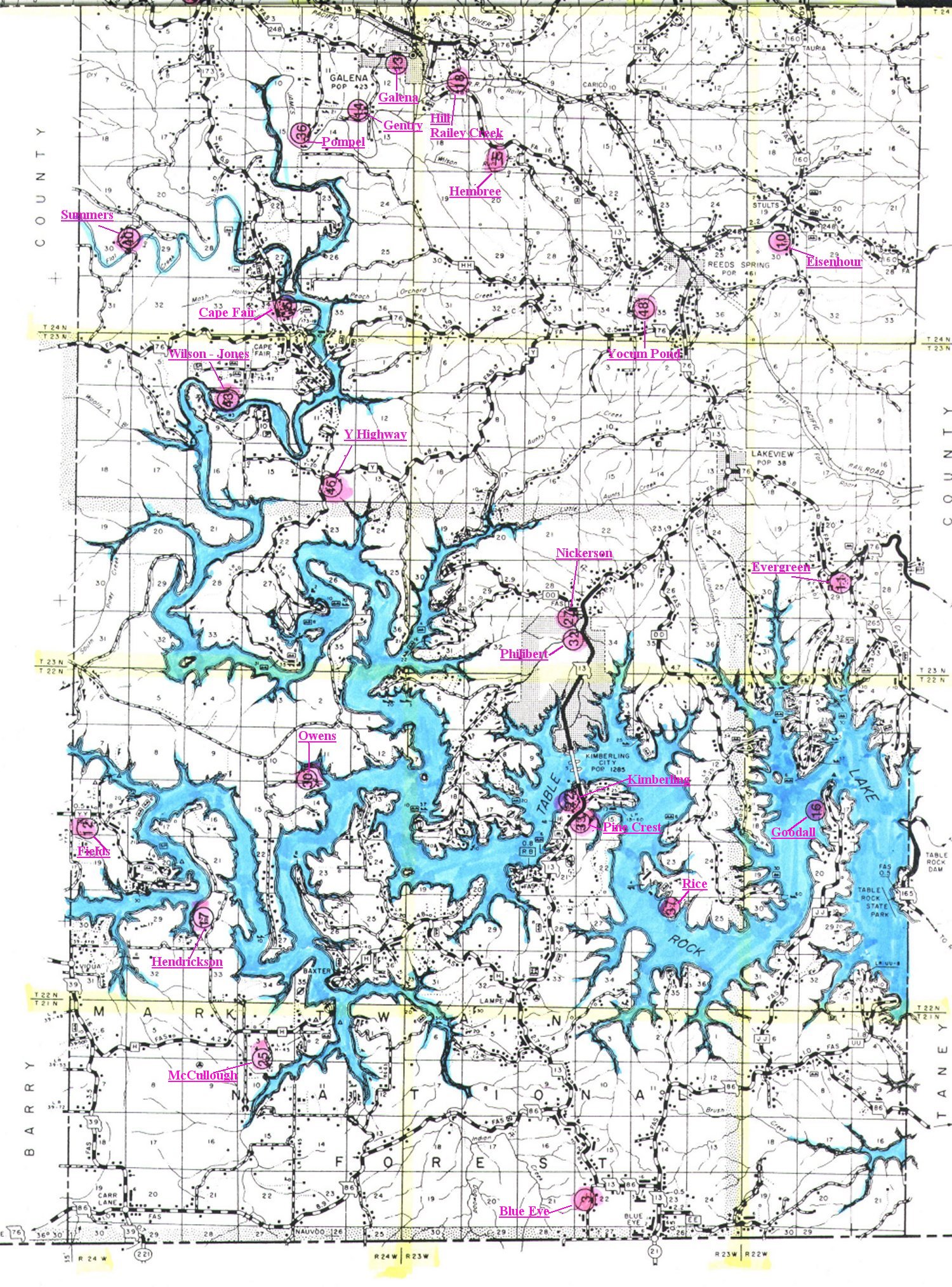
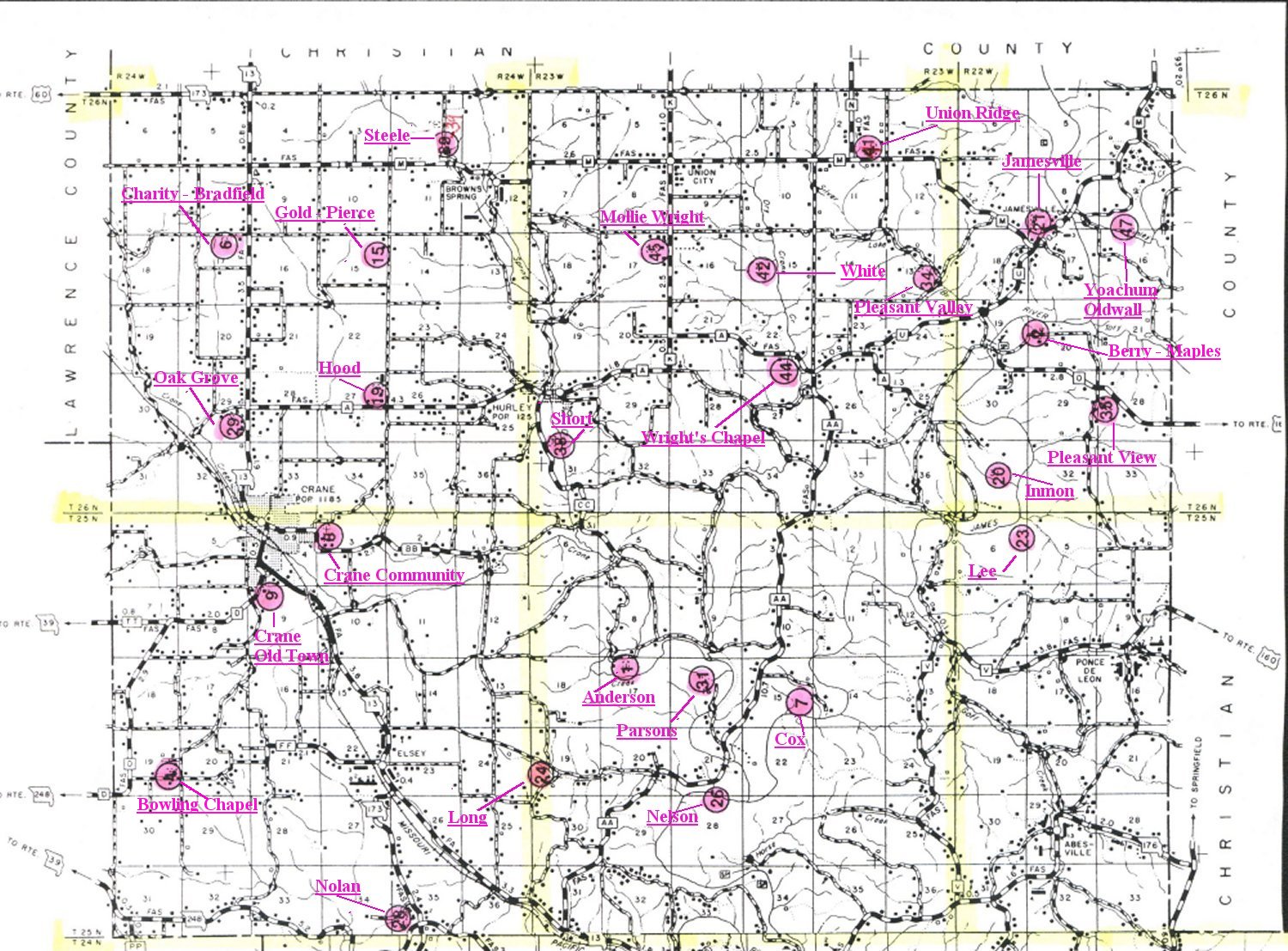
The map had to be divided into two sections for scanning. Clicking on the map sections will enlarge that section so that it can be read.  It is a large file size, so please be patient while it loads.

A list of cemeteries and their coordinates are listed next to the bottom half of the map.

Thanks to Cheri Mello for providing this map showing the locations of forty-nine  Stone County cemeteries.
 

MAP SECTION II

Anderson (1)    T25N  R23W
Berry (Maples) (2)   T26N  R22W
Blue Eye (3)    T21N  R23W
Bowling Chapel (4)   T25N  R24W
Cape Fair (5)   T24N  R24W 
Charity (Bradfield) (6) T26N  R24W
Cox (7)    T25N  R23W
Crane Community (8)  T25N  R24W
Crane (Old Town) (9)  T25N  R24W
Eisenhour (10)   T24N  R22W
Evergreen (11)  T23N  R22W
Fields (12)   T22N  R24W
Galena (13)   T24N  R24W
Gentry (14)   T24N  R24W
Gold (Pierce) (15)  T26N  R24W
Goodall (16)   T22N  R22W
Hembree (49)   T24N  R23W
Hendrickson (17)  T22N  R24W
Hill (Railey Creek) (18) T24N  R23W
Hood (19)   T26N  R24W
Inmon (20)   T26N  R22W
Jamesville (21)  T26N  R22W
Kimberling (22)  T22N  R23W
Lee (23)   T25N  R22W
Long (24)   T25N  R23W
McCullough (25)  T21N  R24W
Nelson (26)   T25N  R23W
Nickerson (27)  T23N  R23W
Nolan (28)   T25N  R24W
Oak Grove (29)  T26N  R24W
Owens (30)   T22N  R24W
Parsons (31)   T25N  R23W
Philabert (32)   T23N  R23W
Pine Crest (33)  T22N  R23W
Pleasant Valley (34)  T26N  R23W
Pleasant View (35)  T26N  R22W
Pompel (36)   T24N  R24W
Rice (37)   T22N  R23W
Short (38)   T26N  R23W
Steele (39)   T26N  R24W
Summers (40)   T24N  R24W
Union Ridge (41)  T26N  R23W
White (42)   T26N  R23W
Wilson, Bolin (Jones) (43) T23N  R24W
Wright Chapel (44)  T26N  R23W
Wright, Mollie (45)  T26N  R23W
Y Highway (46)  T23N  R24W
Yoachum (Oldwall) (47) T26N  R22W
Yocum Pond (48)  T24N  R23W


RETURN TO CEMETERY INDEX

RETURN TO STONE COUNTY MAIN PAGE
 

© 2005 Jo Dunne All Rights Reserved

2407