|
Ray County Genealogy Home Page |
 |
|
|
Ray County Genealogy Home Page |
|
|
Meinking-Wilson Cemetery
|
||||||||
 |
||||||||
| Name of Cemetery | Meinking-Wilson Cemetery | |||||||
| Township | Grape Grove Twp | |||||||
| Cemetery # | #412 | |||||||
| Alternate Names | Cox Cemetery | |||||||
| Latitude/Longitude | Latitude: 39°21'29"N; Longitude: 93°47'60"W (degrees minutes seconds)
Latitude 39 deg 21' 510' N & 93 deg 47' 988' N (degrees minutes minutes) |
|||||||
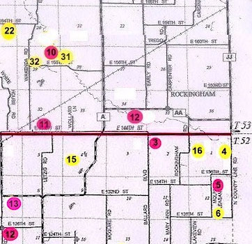
| Township/Range/Section |
T53R26S34; NE1/4 SE1/4 |
|||||||
| Cemetery Still in Use | No | |||||||
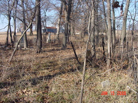
| Size of Cemetery | 16 known stones | |||||||
| Condition | not fenced or mowed | |||||||
| Range of Burial Dates | ||||||||
| Oldest Known Stone: | John S. Pugh d. December 27, 1951 | |||||||
| Last Known Burial | Nancy E. Wilson d. August 16, 1901 | |||||||
| Visited yet? | CC - yes................ JZ - yes...........anyone else - yes | |||||||
| Location/Directions/Comments | ||||||||
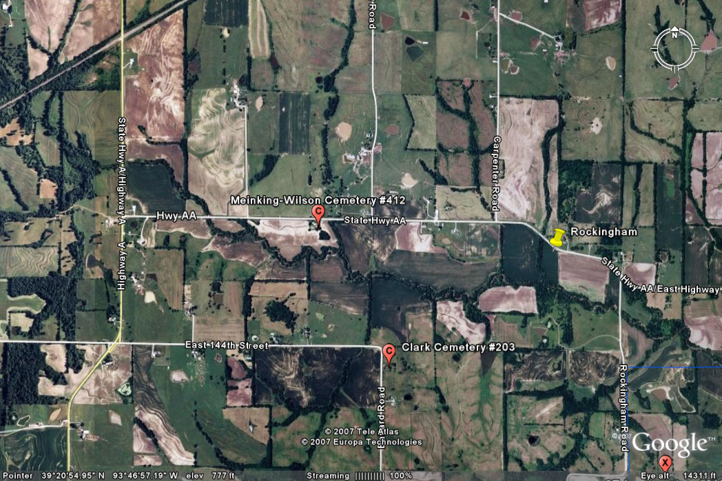
| Most recent directions | From the intersection of Hwy A and Hwy AA travel east on Hwy AA 7/10 miles. Cemetery is located about 50 yards south of the road in a grove of trees (southeast of the house).
48227 Hwy AA |
|||||||
| 1973 Ray County History; p. 230 | not shown | |||||||
| 1973 Ray County History; p. 232; Cemeteries Not Listed on Map | #24: Cox Cemetery is on south east part of James Bowman farm, Route AA | |||||||
| Big Black Cemetery Binder | Cox Cemetery is on private property. Located in wooded area on south side of Route AA approximately 3/4 miles east of Route A on Lamar Carpenter property in NW 1/4, SE 1/4, Sec 34, Twp 52N, Rng 26W, Crooked River Twp. This area very well kept. [CC comment: even though it says Crooked River Twp, these coordinates would place it right at Meinking-Wilson Cemetery in Crooked River Twp] |
|||||||
| Cemeteries of Grape Grove Township by McKemy | On south side of route 'AA'; 3/4 miles east of route 'A'; located in a grove of trees near the road; about 13 marked graves (1989) | |||||||
|
Ancestry.com |
xxxx |
|||||||
|
DAR Index: |
Meinking/Wilson (Cox) Cemetery is located about 3/4 miles east of Route A, on Route AA on the south side of the road in a clump of trees |
|||||||
| LS info | xxx | |||||||
| Other Comments | xxx | |||||||
| Plat Maps | year | marked? | who's land? | |||||
| 1877 | no | F. Minking | ||||||
|
1897 |
yes | Fred Manking | ||||||
| 1914 | yes | J. F. Manking | ||||||
| 1930 | no | J. F. Manking | ||||||
| 1970 | no | Eldred Falls | ||||||
|
1976 |
no | Lamar Carpenter | ||||||
| 1997 | no | Lamar Carpenter | ||||||
| 2005 | no | Lamar Carpenter | ||||||
| Transcriptions online: | ||||||||
| GTT online | ||||||||
| Ray County Archives | ||||||||
| Ancestry.com | ||||||||
| Find-A-Grave | ||||||||
| Other Online Link | ||||||||
| Compilations | Cemeteries of Grape Grove Township, January 1995; compiled by Al McKemy, Mar 1989 | |||||||
| Library References | ||||||||
| Genealogical Library - Ray County Museum | ||||||||
| Ray County Library - Richmond | ||||||||
| Mid-Continent Library | MC 977.819 M195c AFRA | |||||||
| Family History Library (FHL) | ||||||||
| Lookups | xxxx | |||||||
| Ray County Cemetery Project Volunteers | ||||||||
To add additional information relating to Ray County, Missouri Genealogy, E-Mail the county coordinator.
Ray County Home Page | MoGenWeb | USGenWeb | WorldGenWeb | E-Mail County Coordinator
To add additional information relating to Ray County, Missouri Genealogy, E-Mail the county coordinator.