|
Ray County Genealogy Home Page |
 |
|
|
Ray County Genealogy Home Page |
|
|
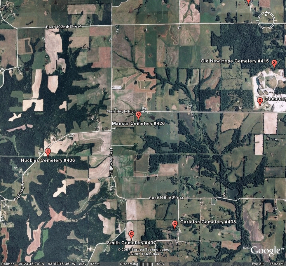
Mansur Cemetery
|
||||||||
 |
 |
|||||||
| Name of Cemetery | Mansur Cemetery | |||||||
| Township | Grape Grove Twp | |||||||
| Cemetery # | #426 | |||||||
| Alternate Names | Unknown Cemetery T53R27S12 | |||||||
| Latitude/Longitude | Latitude: 39°25'21"N; Longitude: 93°52'43"W | |||||||
| Township/Range/Section | ||||||||
| Cemetery Still in Use | No | |||||||
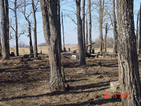
| Size of Cemetery | only 2 readable stones | |||||||
| Condition | almost completely destroyed; in the middle of trees with cattle roaming; some bases were visible | |||||||
| Range of Burial Dates | ||||||||
| Oldest Known Stone | xxxx | |||||||
| Last Known Burial | only two stones found (2008):
Elizabeth wife of Stillman Mansur born Sep. 6, 1821 died Aug 2?, 1__8? Mahala P. wife of Geo. C. Keas died Nov. 6, 1879 aged 73 ys. 28 ds. |
|||||||
| Visited yet? | CC - yes................ JZ - yes/no...........anyone else - yes/no | |||||||
| Location/Directions/Comments | ||||||||
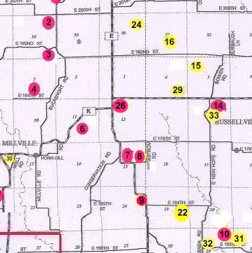
| Most recent directions | From the intersection of Hwy 'E' and Hwy 'K', at the point where Hwy 'K' turns straight east, travel 3/10 miles to the first gate on the south side of the road. Proceed through the gate on the farm path, across a creek and up a small hill. Cemetery sits in the trees. [Please be sure to ask permission from the land owner, who lives on the north side of the road across from the gate. Cattle graze this entire area.] | |||||||
| 1973 Ray County History; p. 230 | xxx | |||||||
| 1973 Ray County History; p. 232; Cemeteries Not Listed on Map | xxx | |||||||
| Big Black Cemetery Binder | xxx | |||||||
| Cemeteries of Grape Grove Township by McKemy | xxx | |||||||
|
Ancestry.com |
xxxx |
|||||||
|
DAR Index: |
xxx |
|||||||
| LS info | xxx | |||||||
| Other Comments |
this could be the Duval - Rice Cemetery. Duval - Rice Cemetery is marked on the 1914 atlas where a Duval owned that land in 1877. However....there are a lot of "Mansur's" who owned land in that area from the original land records to the 1914 atlas. |
|||||||
| Plat Maps | year | marked? | who's land? | |||||
| 1838 | In "Original Land Entries" of Ray County p. 86 Isaiah Mansur bought land in 1838 in T53R27S12 e1/2 of NW1/4 | Isaiah Mansur | ||||||
| 1877 | no | I. Duval | ||||||
|
1897 |
no | Martha E. Rush | ||||||
| 1914 | yes | E.P. Moffitt | ||||||
| 1930 | no | E.P. Moffitt | ||||||
| 1970 | no | Carl D. Pulliam | ||||||
|
1976 |
no | Carl D. Pulliam | ||||||
| 1997 | no | Carl Pulliam | ||||||
| 2005 | yes | Carl Pulliam | ||||||
| Transcriptions online: | ||||||||
| GTT online | ||||||||
| Ray County Archives | ||||||||
| Ancestry.com | ||||||||
| Find-A-Grave | ||||||||
| Other Online Link | ||||||||
| Compilations | xxxx | |||||||
| Library References | ||||||||
| Genealogical Library - Ray County Museum | ||||||||
| Ray County Library - Richmond | ||||||||
| Mid-Continent Library | ||||||||
| Family History Library (FHL) | ||||||||
| Lookups | xxxx | |||||||
| Ray County Cemetery Project Volunteers | ||||||||
To add additional information relating to Ray County, Missouri Genealogy, E-Mail the county coordinator.
Ray County Home Page | MoGenWeb | USGenWeb | WorldGenWeb | E-Mail County Coordinator
To add additional information relating to Ray County, Missouri Genealogy, E-Mail the county coordinator.