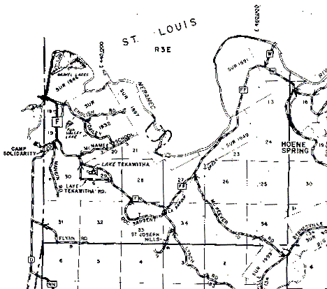
The southern boundary of the township is the darker, solid horizontal line near the bottom of the map (it passes just south of where "Flynn Rd" is written on the map). The eastern boundary is the solid vertical line passing through the "O" and "P" of "Hoene Spring", and the western boundary is the first vertical line near the map's left edge. The northern boundary is the Meamec River, with St Louis County on the north side of it.
