
Ferguson Cemetery
Located in Newton Co., MO near Barry Co., line
Van Buren Twp. - Land Office Location: Section 11, Twp. 25N, Range 29W
Photos taken in 2006 by: Jack Fly
Directions: From the intersection of Highways 60 & 37 in Monett, MO,go about 6 miles west on 60 hwy. Turn south (left) on FR1010.
There will be a sign for Jolly Mill at this intersection. Turn west (right) on FR2025. Continue west on FR2025 until you come to Jolly Mill. On the south side of the road opposite the entrance to Jolly Mill Park will be a small parking lot and the gate to the Missouri Conversation land.
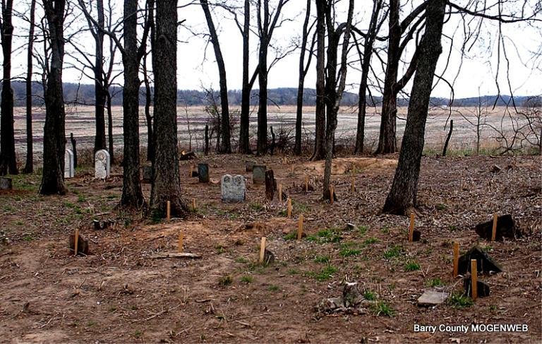
The cemetery is south south-west of this point in a grove of trees.
The Ferguson Cemetery is located in Newton County within site of the Barry/Newton County line. It is west of the Jolly Bethel Cemetery at Jollification and directly south of Jolly Mill. The cemetery contains the remains of members of the Davis Ferguson family and others.
Davis Ferguson married Rhoda H. Rogers, January 23, 1828, in Franklin Co., Virginia and brought their family west, via Tennessee, to arrive in Newton county before the 1840 census rider made his rounds.
Davis Ferguson was a surveyor and farmer. In the fall of 1843 he surveyed a road from Hazeltine in Greene County to the Indian Territory routing it through Neosho. In 1849 he surveyed and marked the western boundary of Barry County.
The Ferguson's were slave owners and it is thought that the eleven identified graves marked only with field stones are those of their slave population.
Today the cemetery lies on land owned by the Missouri Conservation Department and is only accessible by foot. In February 2006 the cemetery was cleared and stones were repaired and reset by Jack Fly, Ted Roller, Jay Trace with the help of Roger Terry, Roger Theriault, and Jerry Morton.